
Backpacking Yosemite National Park in 7 Days

This post follows our 7 day backpacking trip though the heart of Yosemite National Park, starting from Tuolumne Meadows and ending, a little over 50 miles later, down in Yosemite Valley.
It's hard to describe in words and photos what it feels like to be there, to spend a whole week deep into the mountains and valleys of Yosemite National Park. It's surreal, and we were so lucky to have been able to do it, so I'm going to try to tell our story and I hope I'll convince you that you need to go see it for yourself.
Backpacking Yosemite with a Guiding Company
The summer before, we went to see Zion and Brice National Parks and the Escalante National Monument in Utah. We took a friend's advice and hired a guiding company to handle logistics for us, since we did't know much about Utah, and we also wanted to avoid researching the trip ourselves at the time. Our friend Sheri recommended Wildland Trekking, a company that she's traveled with before. I'm glad we chose them, because we had a fantastic experience, based on which, we asked to join their Yosemite trip too!
Getting to Yosemite Valley
We decided to fly into Fresno, a direct flight from Seattle, and spend the first night there. The following morning, since we didn't want to rent a car just to leave it parked at the trailhead for a week while we were in the backcountry, we took Amtrak to Merced, then boarded the Yarts bus to Yosemite Valley. It took a while, but it was very pleasant to ride public transportation and enjoy the view.

Riding Amtrak from Fresno to Merced, on our way to Yosemite Valley, California
Yosemite Valley
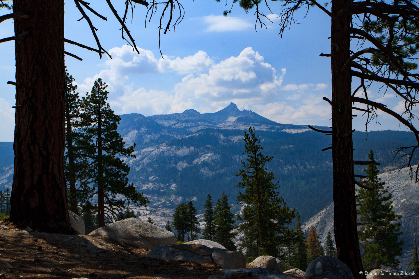
We deliberately arrived a couple of days early, to allow us to see the touristy side of Yosemite Valley, and we were treated with a shock! There were thousands of tourists in the valley, buses full of people, food and store lines were at least 10 customers long and overall it was very, very crowded. We felt like we came to the wrong place. But that was about to change soon, we thought, so we decided to hang on, and take a quick tour of the surroundings.
Half Dome
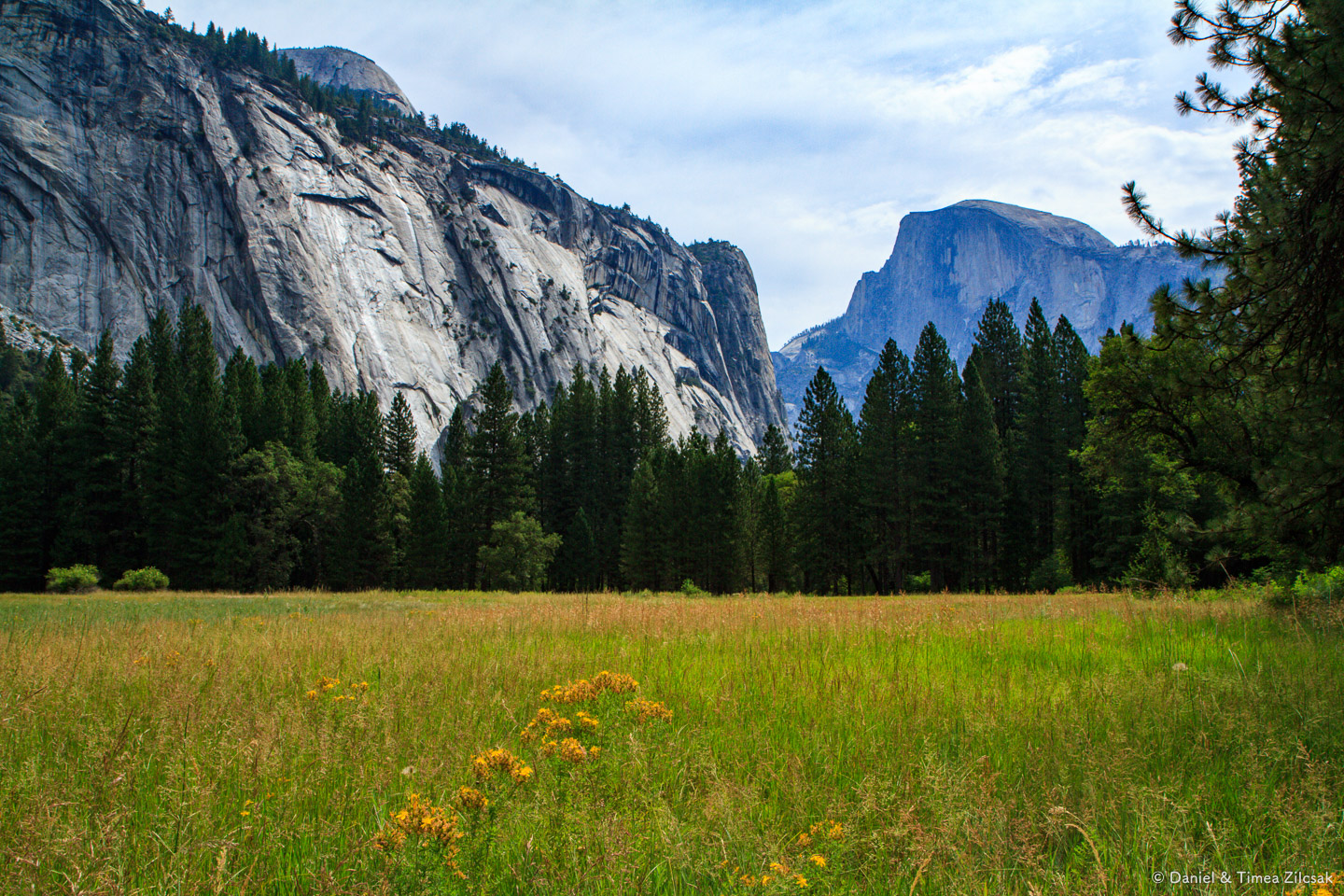

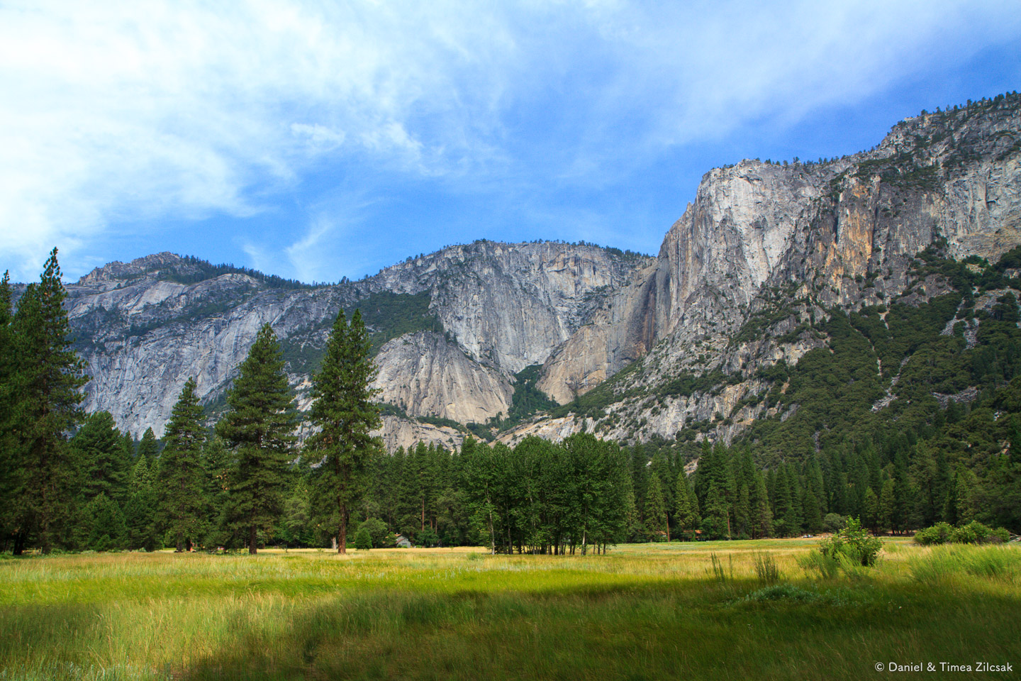
El Capitan and Yosemite Falls


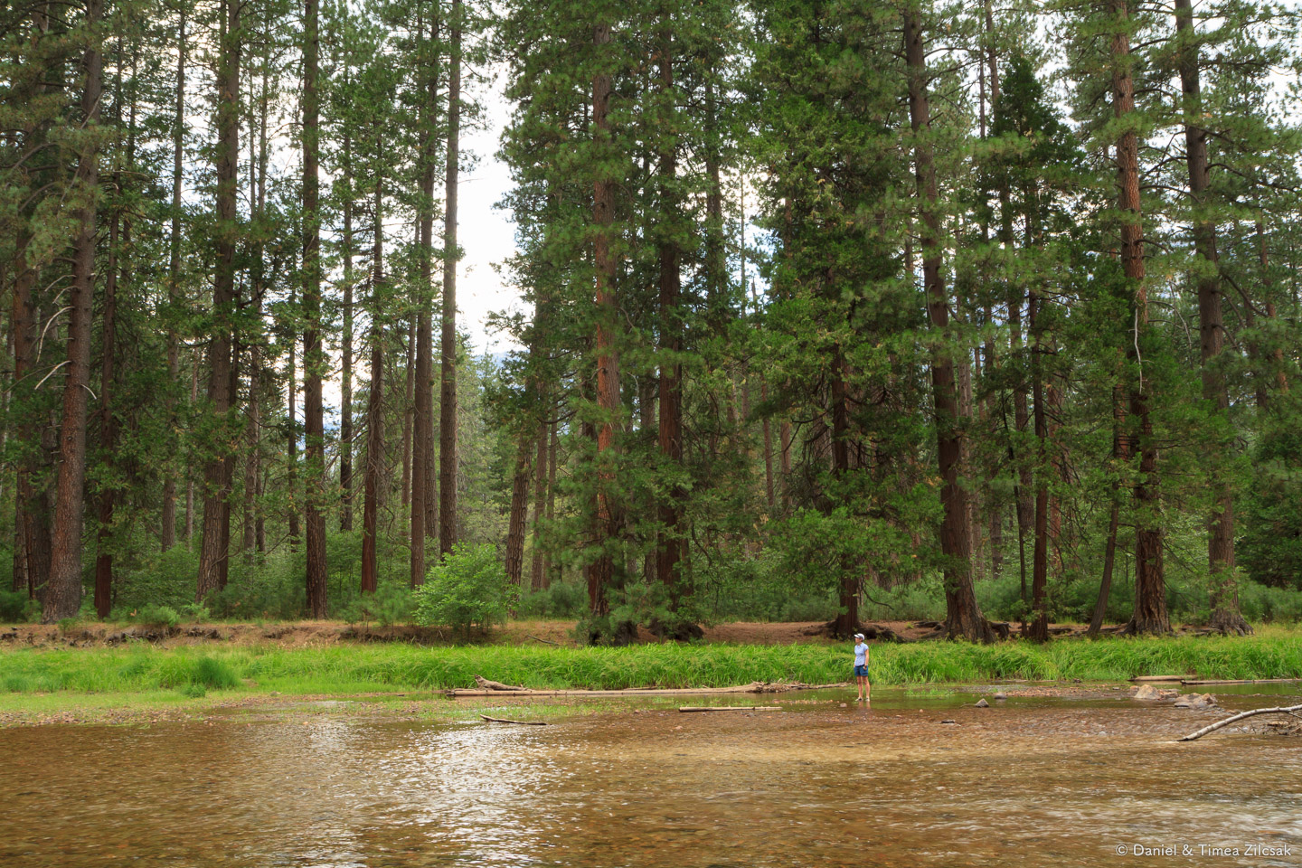
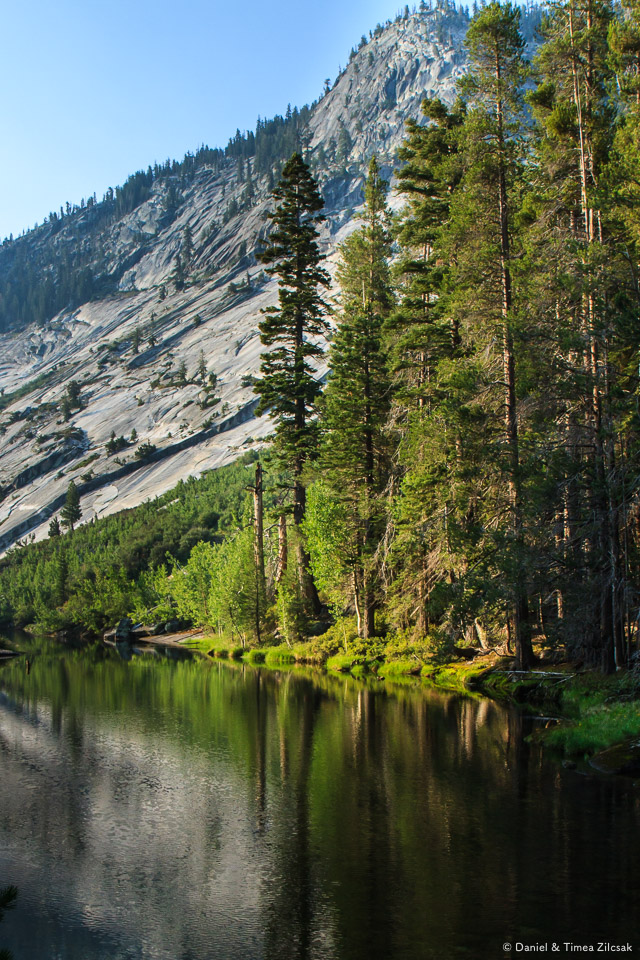
Merced River, Yosemite Valley

Curry Village, the best place to stay in Yosemite Valley
We spent two nights in Yosemite Valley at the tent cabins in Curry Village. They totally exceeded our expectations in both comfort and coziness. We enjoyed the hot showers, the proximity to the grocery store and food. We also enjoyed a little show they put on for us visitors at the village theater. It was a story about the history of climbing El Capitan. What else could we ask before the beginning of our own backcountry adventure.

Tent cabins at Curry Village, Yosemite Valley

Enjoying a show at the Curry Village outdoor theater

Bear sighting report sheet at Curry Village visitor center
From Yosemite Village to Tuolumne Meadows
We met our guide the night before, talked about the trip, checked gear and, most importantly, met everybody else in our group. We all decided to get an early start, so, at 8 am, we were already waiting for the Tuolumne Meadows bus.
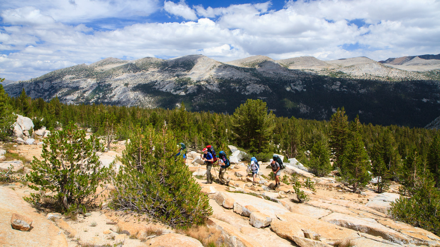
The ride to Tuolumne Meadows took a couple of hours and we were lucky to get a front row seat on the bus, so we enjoyed the views. Somewhere in the middle of the ride, I think it was near Tenaya Lake, the bus took a short 5 minute stretch break.

Riding a fancy bus from Yosemite Village to Tuolumne Meadows
Day 1: Lyell Canyon
We stopped for a quick lunch on the patio at Tuolumne Meadows Lodge and, shortly after, we entered the nearby John Muir trail.

John Muir Trail sign near Tuolumne Meadows Lodge- Backpacking Yosemite
Even though the sign says 27.5 miles to Yosemite Valley, we were going to take a longer route to give us enough "trouble" for the 7 days we planned to be there. If I remember correctly, we ended up hiking a total of a little over 50 miles.
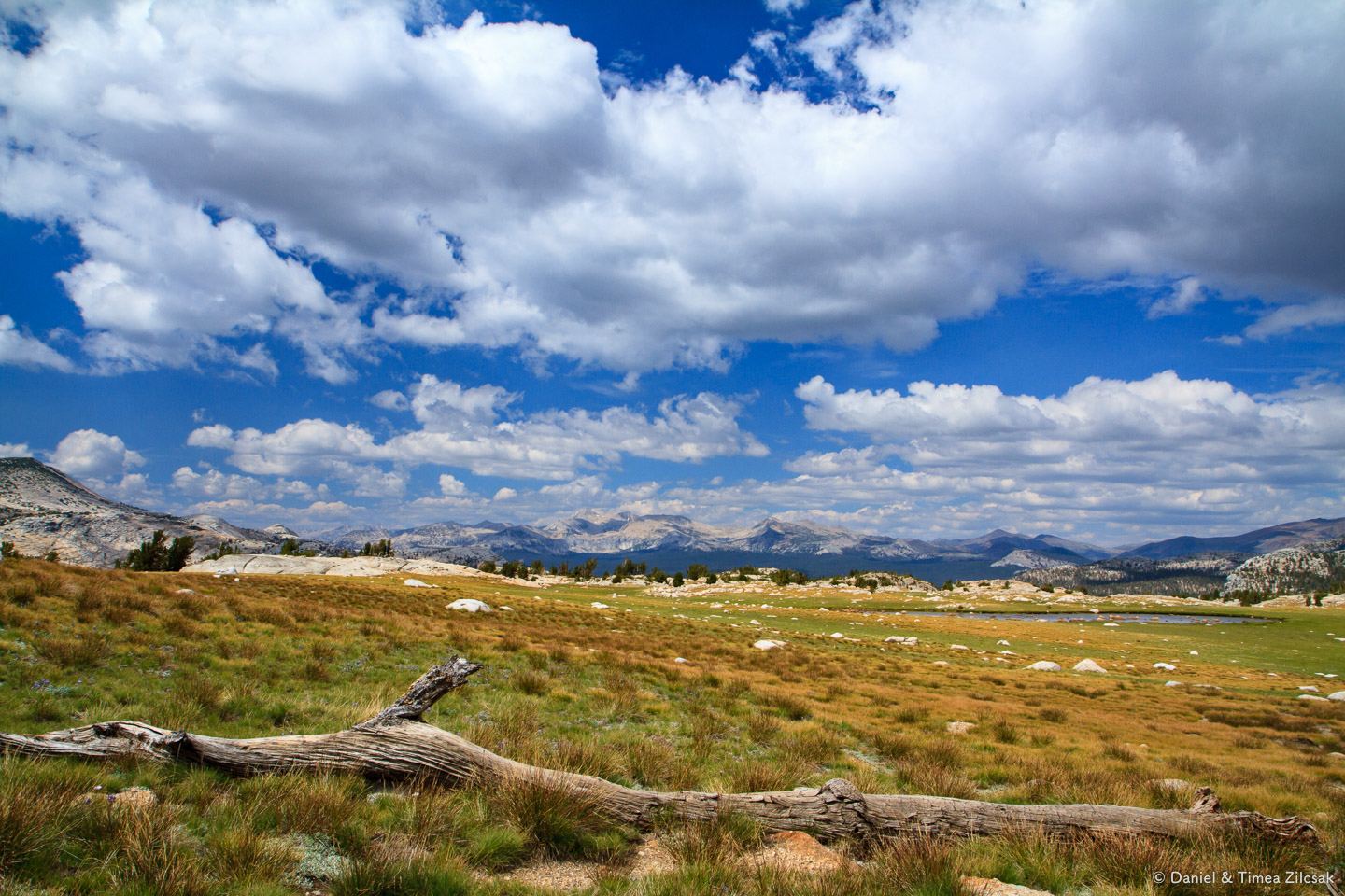
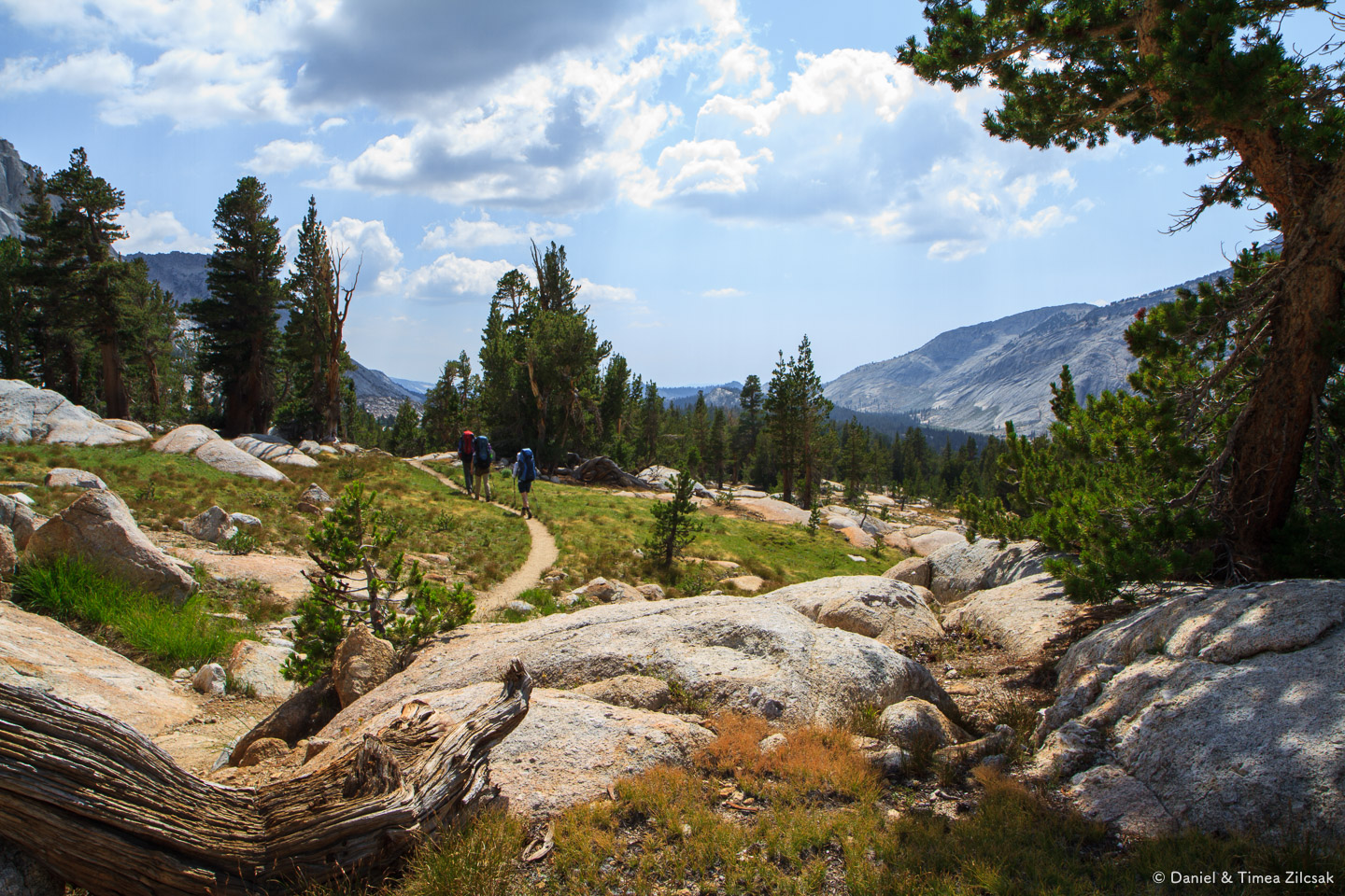
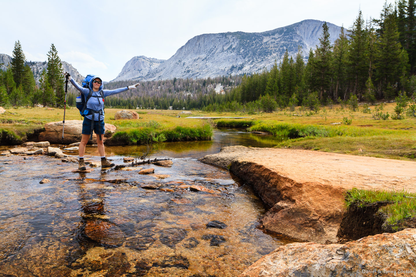
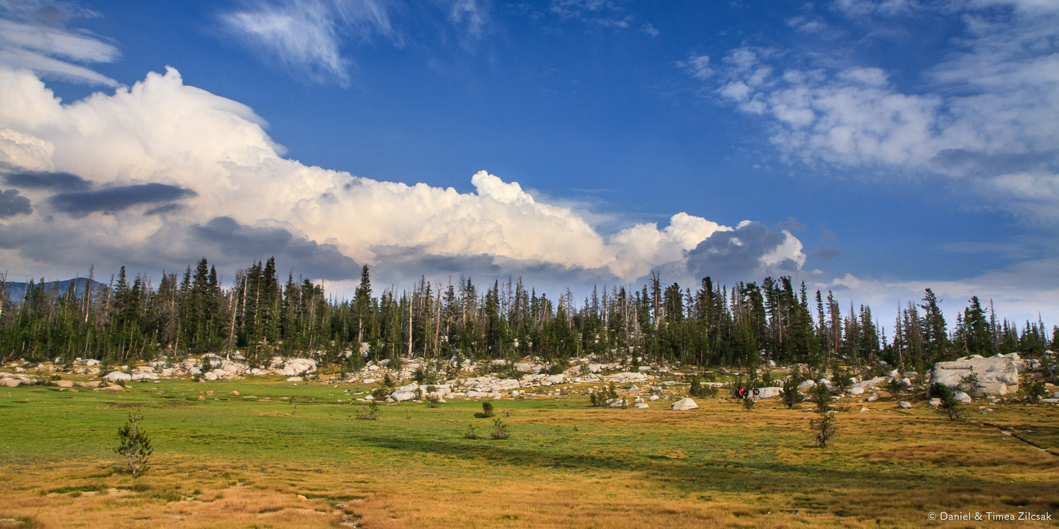
As soon as we entered the trail, we were pleasantly surprised by the Lyell Fork of the Tuolumne River and the Lyell Canyon's meadows. It felt like we were hiking through a wonderland.

Lyell Fork of the Tuolumne River - Backpacking Yosemite
We hiked for a few good hours on a flat but beautiful trail through Lyell Canyon. Weather was not peachy, but the temperature was great for hiking, probably in the mid fifties. However nice the trail was, it could not compensate for the effects of altitude, as I began to feel a slight headache. I was not surprised since we were hiking in the high eight thousands, an elevation where I usually get mild AMS (acute mountain sickness).

Hiking along the Lyell Canyon - Backpacking Yosemite
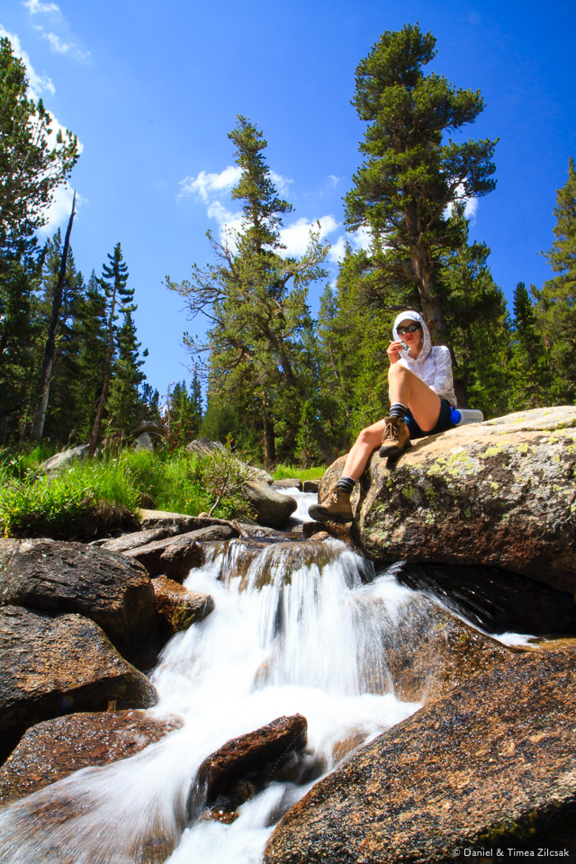
Along the way, we could see these beautiful puddles, with nearby rocks where marmots will lye and make their presence known.

Beautiful meadows of Lyell Canyon and puddles of water from the Lyell Fork of the Tuolumne River
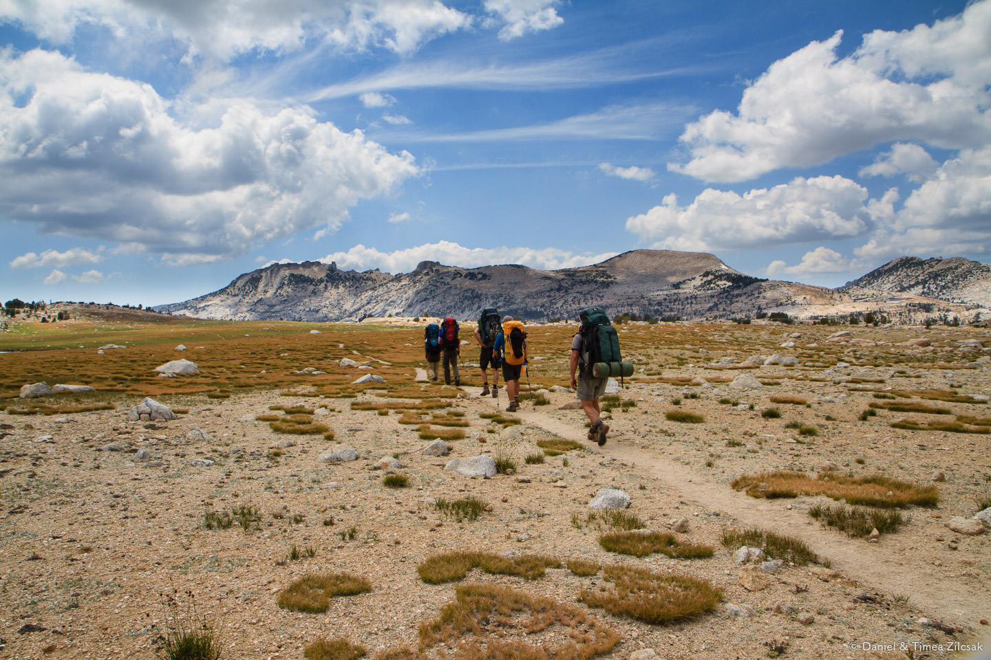
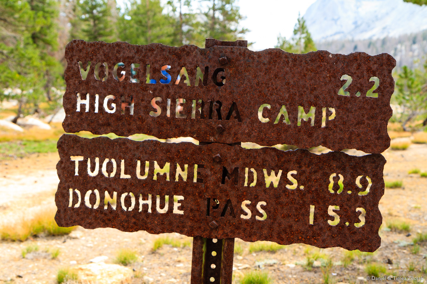
After 5.3 miles through the canyon, near Ireland Creek, we arrived at the Evelyn Trail junction where our first camp was going to be. We left the John Muir trail behind and headed up the trail, towards Vogelsang High Sierra Camp, to look for a camp site.
Day 2: Lyell Canyon to Vogelsang High Sierra Camp
The first night sleeping outside is always like that, I question every noise I hear because it's so quiet. Every branch crack or cone dropping on the ground sounds like an evil bear coming to get me and my food. I eventually give up making up scenarios in my head and fall asleep.
That's exactly how it was this time too, only to find out in the morning from a nearby backpacker that a bear was indeed in our camp that night, looking to steal the food they could not fit in the bear canister (their big mistake) and had to hang it in a tree. They managed to scare the bear away while we had no clue what was going on.

Our camp at Ireland Creek near Lyell Canyon, Yosemite National Park
We took our time packing and left camp a little later that morning. We knew the weather will turn nice, and here it was, sunny again.
The hike from Ireland Creek towards Vogelsang starts with an uphill section, unlike the mostly-flat Lyell Canyon. We hiked along the creek for a while and stopped for a snack after gaining some elevation (close to 9600ft).
Ireland Creek on our way to Vogelsang High Sierra Camp
Snack break near Ireland Creek

Into the alpine zone - Backpacking Yosemite
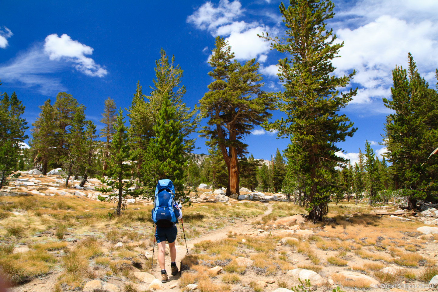
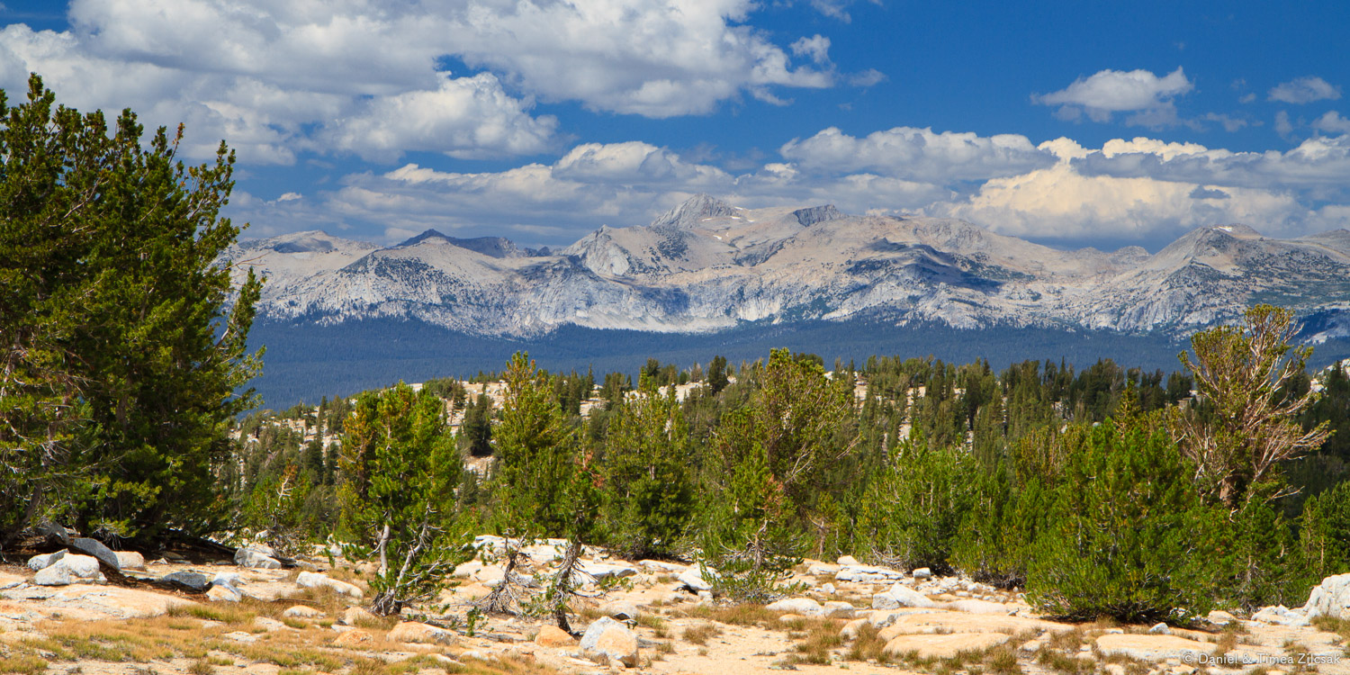
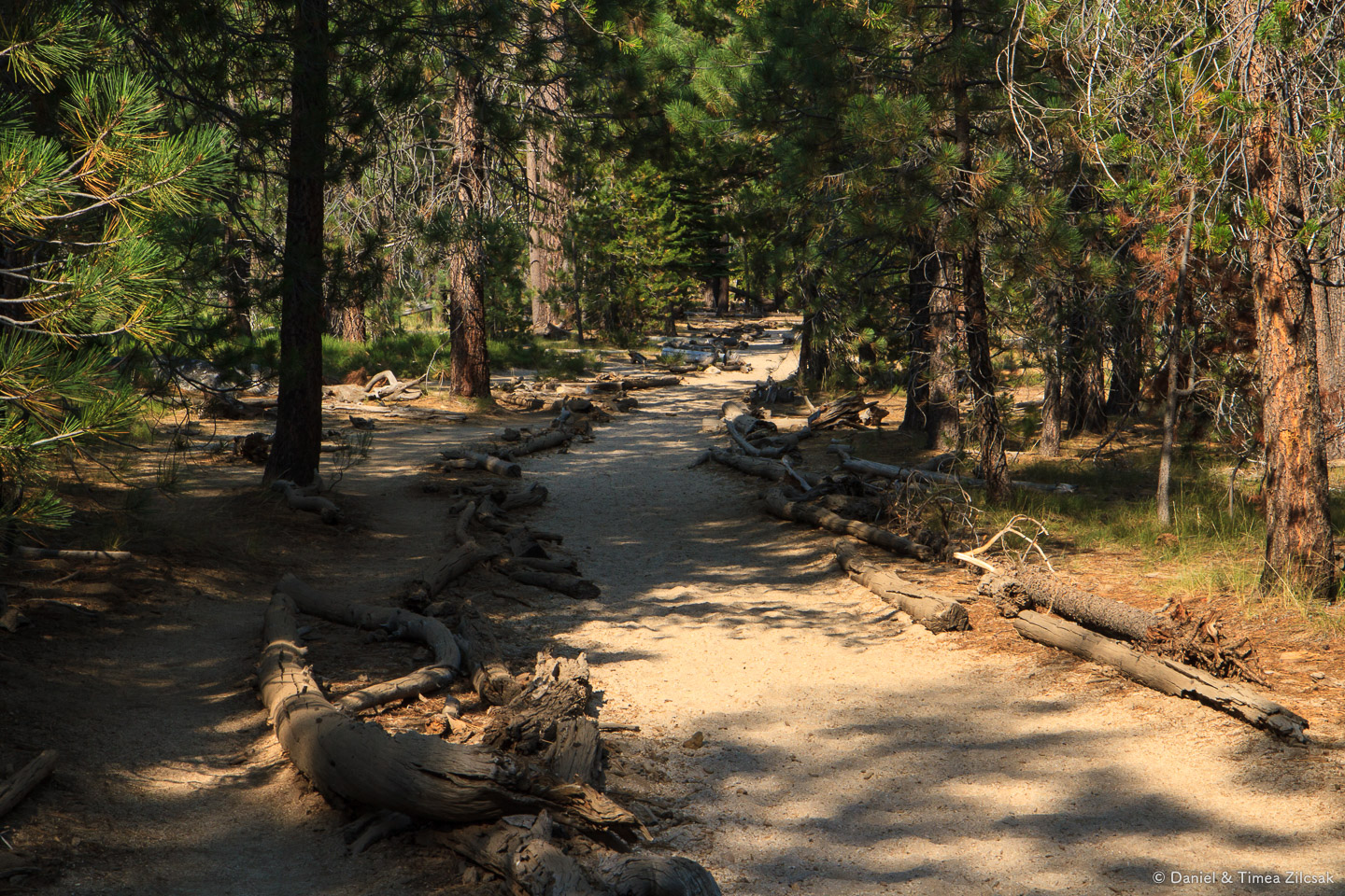
Hiking, hiking, hiking, through the wonderfully scented pine forest of Yosemite. We passed the 10k mark by now and we were in high elevation country, yet I was feeling just fine. No altitude symptoms at all, yay!
The next couple of hours were the most memorable for the day. The views were just breathtaking. Gallery:
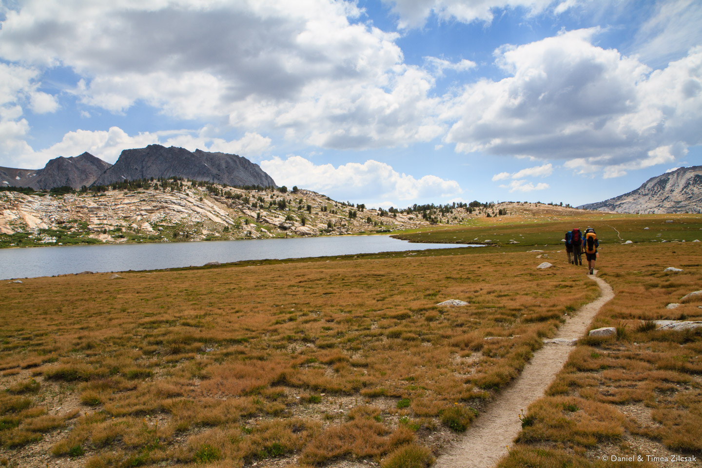
After descending into a large meadow, and traversing a couple of creeks, we reached Evelyn Lake with views towards Fletcher Peak and the rest of the Sierras on the other side, far in the distance. Just a few more turns and we'd be at Vogelsang Camp.


Fletcher Lake and Fletcher Peak
Not much time has passed since we left Evelyn Lake behind and boom, we see Fletcher Peak in all its rockiness and grandeur.

Fletcher Peak, about 11400 ft high - Backpacking Yosemite
The next photo is another view from further down the trail. Around here is when we found out that our camp is five minutes away. The immediate thought that crossed our mind was to take a dip. We resisted, took care of camping first, then came back, not for a swim, but rather for a 20 second dip in/get out. The water was very, very cold (not that we had expected otherwise).
This experience right there was a defining moment of our trip. It marked the moment where we were no longer connected with where we came from - civilization. Our wilderness experience could now truly begin.

Fletcher Lake and Fletcher Peak right above it - Backpacking Yosemite
When we took the detour to the lake, we somehow missed the campsite mark, and were scouting around this creek for a place to lay our tents.

Fletcher Lake outlet and the beginning of Fletcher Creek - Backpacking Yosemite
Vogelsang High Sierra Camp
We eventually found a great place to camp. To be honest, when I think of Vogelsang, this is the first image that comes to mind. It's one of my most vivid memories of this trip!

Our camp at Vogelsang High Sierra Camp bathed in warm sunset rays - Backpacking Yosemite
But this dream location was not meant to be. Some of the employees of Vogelsang Camp proper (Vogelsang is a High Sierra Camp, with a horse establishment, tent cabins, running water, etc) were having a party that night, just 200 ft from where we set camp, and they made sure to come and tell us about it. With some argument back and forth, and repeated visits from various dudes, we eventually decided to move our camp downstream and chose this other spot. Still, you can't beat a sunset in the Sierras.

Sunset from camp at Vogelsang High Sierra Camp - Backpacking Yosemite
Day 3: Vogelsang to Merced Lake
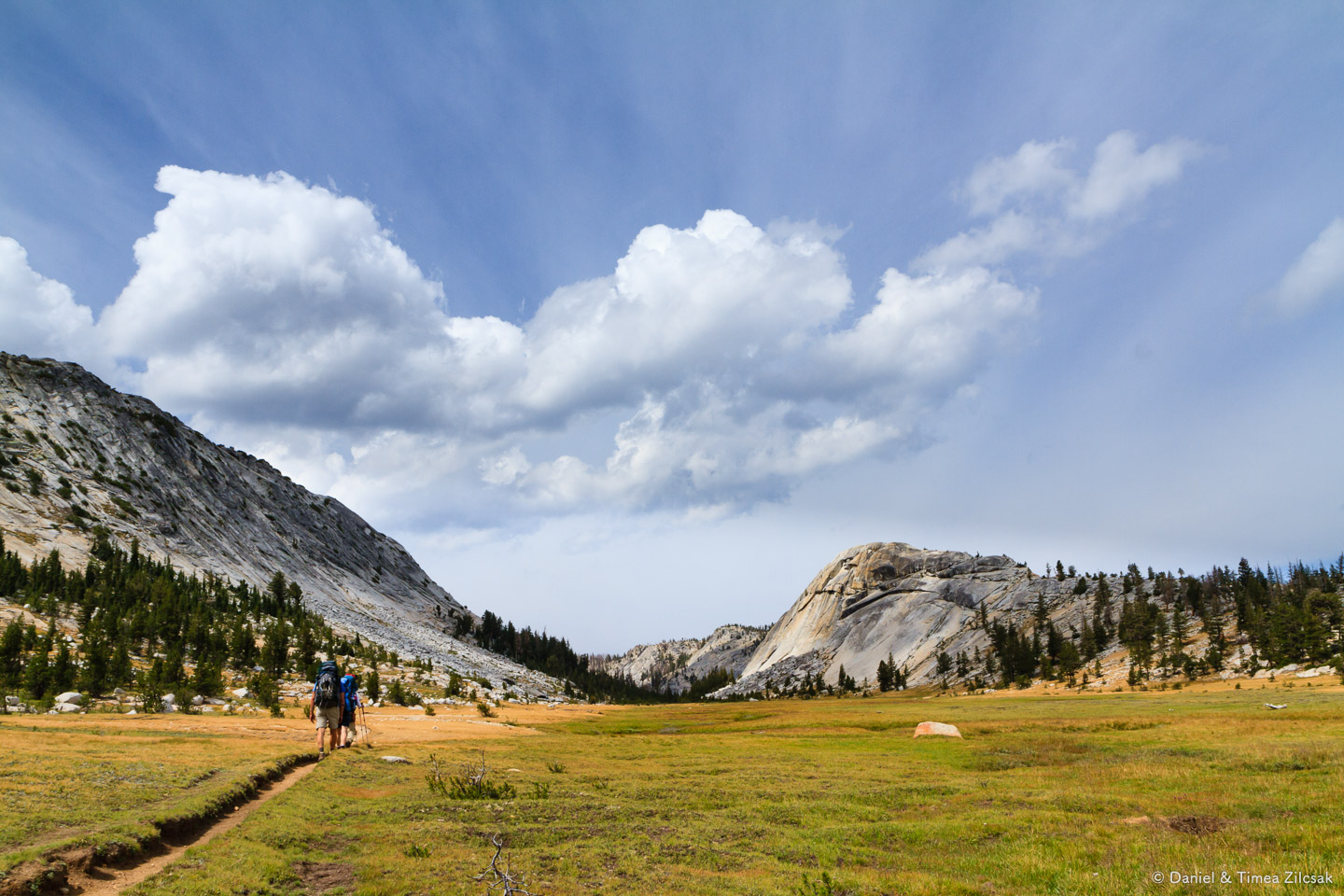
We woke up early that day, not that we needed to get very far, but because we wanted to spend some time in the afternoon relaxing, and maybe taking another bath at Merced Lake. We traveled only 6.3 miles the day before, all uphill, and now we faced a much easier hike of 7.8 miles, all going down. The elevation loss from Vogelsang to Merced Lake is about 2800 ft.
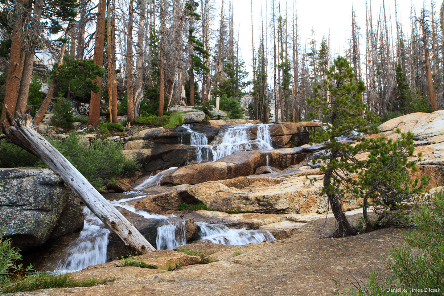
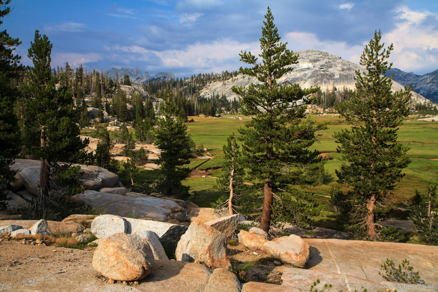
The first 2 or so miles out from Vogelsang traveled through flat and wide meadows, then switched into a steeper trail along waterfalls and majestic granite cliffs.


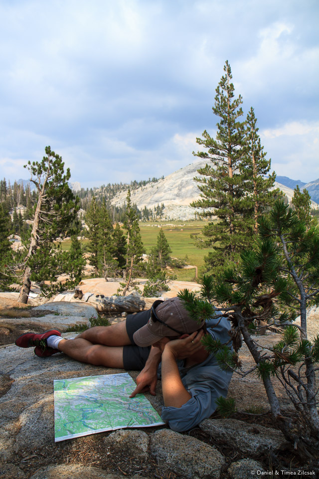
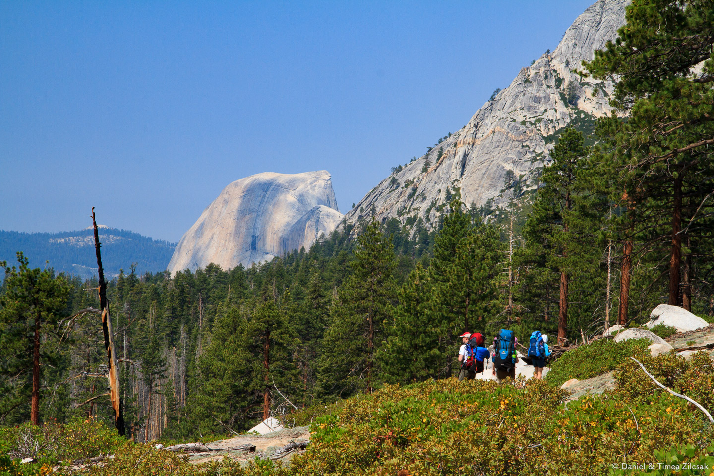
With loosing elevation, taller trees began to make an appearance, and we descending into the subalpine. Since we were doing so fine on time, Joe suggested that we take a small 0.3 mile detour and have lunch at Babcock Lake. After lunch it didn't take too long before we exited the narrow corridor that we'd been into for a while and got a nice view in the distance. It was time to bring out the map and give our expert opinion in naming the peaks we see. One of them was Half Dome, with its distinctive shape, far away in the distance.

Half Dome far away in the distance, view from the trail descending into Merced Lake - Backpacking Yosemite
After some other peak naming attempts, more or less successful as it was to be later proven, we realized that weather was turning against us, very quickly.
Majestic granite cliffs descending into Merced Lake - Backpacking Yosemite
In less than 10 minutes, rain was upon us, and not just rain, but a bad thunderstorm with hail and all. We took shelter underneath a smaller tree, took out our rain shells and pack skins and sat quietly listening to the sounds of the storm while waiting for the worse of it to pass.
Imagine the rock in the image above covered in a river of water, shiny and scarred by the gushing streams that were flowing down its face. That's exactly how it was. A little frighting to see the power display of water.
The abundant rain and hail didn't last long. After about 30 minutes of being miserable, we took the trail again with a feeling of awe towards the power of nature.
Merced Lake High Sierra Camp
I don't remember exactly when we arrived at Merced Lake, but it was no later than 4 in the afternoon. The camp was all in the trees, with no views of the lake whatsoever.

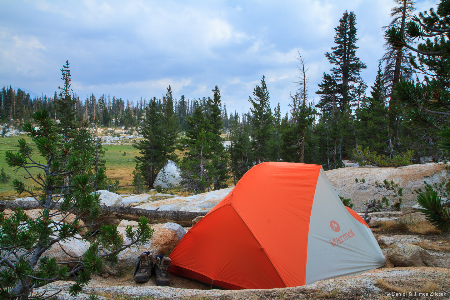
Camp at Merced Lake
Once in camp, rain stopped completely and a few rays of sun allowed the group to dry some of the gear that got wet during the storm. We laid our tents and got everything set for the night, then we went to check out the area around camp.
To our surprise we found that Merced Lake (another one of the High Sierra Camps) has a small store, supplied by mules, where you can find a few very welcomed goodies. We took advantage of it and got our pockets filled with M&Ms, Snickers and fruit. This has really warmed our hearts.

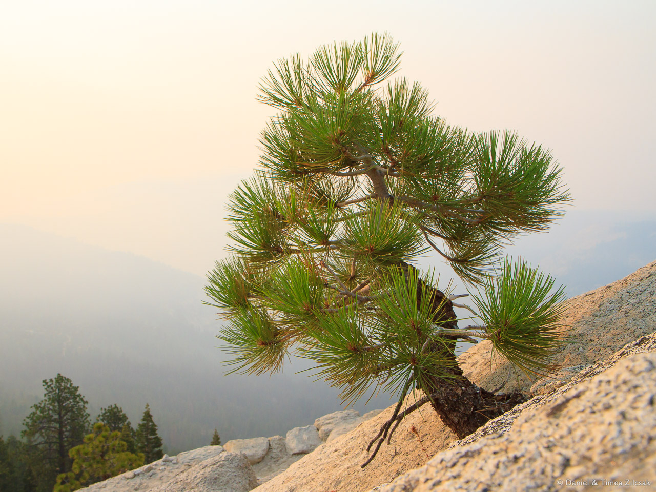
Ponderosa pine cone at Merced Lake Camp, Yosemite National Park
Camp Fire at Merced
We had a wonderful day, with some unexpected surprises, but who would have guessed that another one would arise soon, one that would become a highlight of the trip. It was a camp fire organized by ranger Dave, one of the funniest people I have ever met. He gathered everyone around, and while casually attending the fire, told several stories about the history of Yosemite, how the park came to be and about its most beloved inhabitant - the black bear. We laughed our butts off for the entire duration of his talk. A great way to end a full day.
Day 4: Merced Lake to Sunrise High Sierra Camp
Day 4 was going to be a 10.4 mile day, all uphill, but our packs were lighter now and we had a great night sleep. After learning from the day before, we chose to avoid the storm and make a much earlier start.
We were on the trail by 7:30 am.
Right from the get go we passed by Merced Lake's shore in the gentle morning rays. Weather was going to be nice with a slight chance of thunderstorms in the afternoon. But we really didn't want to experience that lightning again, so we were determined to hike quickly.

Merced Lake after sunrise, Yosemite National Park

Merced Lake in the early morning rays, Yosemite National Park
Merced Lake early morning reflection, Yosemite National Park
We were accompanied by the Merced River for a while, then, in Echo Valley we followed two junctions that took us heading up to Sunrise, our next camp.

Merced River at approximately 7200 ft of elevation, Yosemite National Park

Beautiful flowers in a meadow traversing Echo Valley, Yosemite National Park
Cathedral Fork
This 6.1 mile stretch along Cathedral Fork was not much out of the ordinary. We passed a group of riders heading the opposite way, going down to Merced Lake to change the scenery. A highlight was, of course, that Ritter Sport dark chocolate. Yum!

Riders from Sunrise Camp going down to Merced Lake for a day trip, Yosemite National Park, CA

Hiking up towards Sunrise, Yosemite National Park

A Sooty Goose in Yosemite National Park
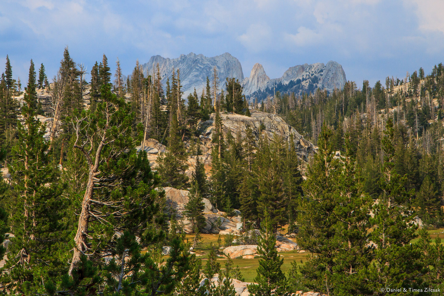
It felt like forever hiking thought this hot valley. Eventually we reached the final big bend and started climbing the final stretch towards the Sunrise ridge. At that point we were high enough to see the Cathedral Range peaks though the trees. Clouds were forming, announcing a storm again. We were optimistic about reaching camp before it.
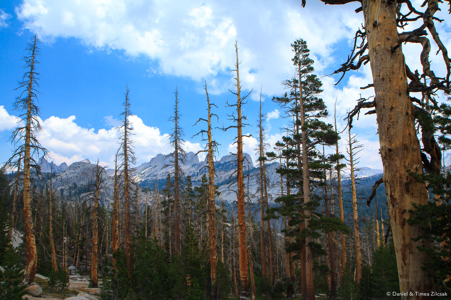
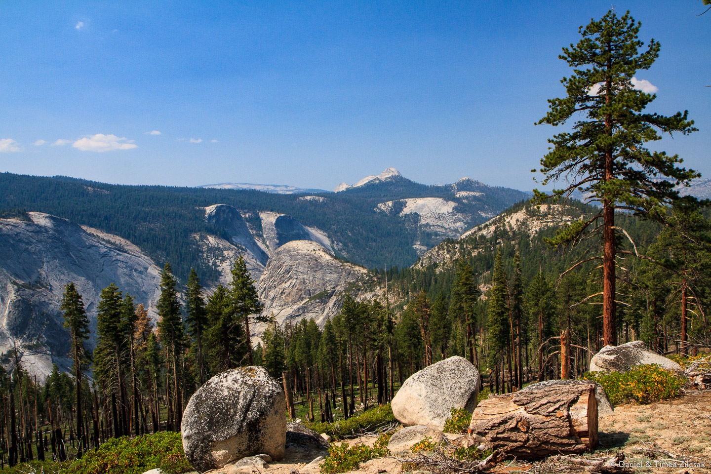
Cathedral Range with its razor sharp peaks, Yosemite National Park
Sunrise High Sierra Camp
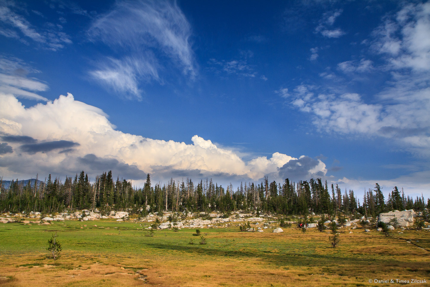
A long time has passed since we started that morning, and the group was very excited to see that we finally reached the absolutely stunning Sunrise meadows, and our camp. It was around 3:30 pm. The hike was long and somewhat monotone, but the views we found along the way were out of this world, and totally worth the effort.
Sunrise is among the very best camps I have ever set foot in, and here are a few photos to prove it. The views there are just stunning!
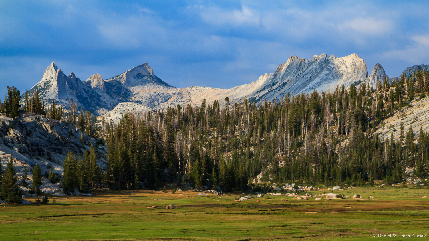

After relaxing for a while, we took a walk up trail and found this great spot where the Cathedral Range was just showing off, in the most beautiful sunset light.

Cathedral Range from Sunrise meadows, Yosemite National Park
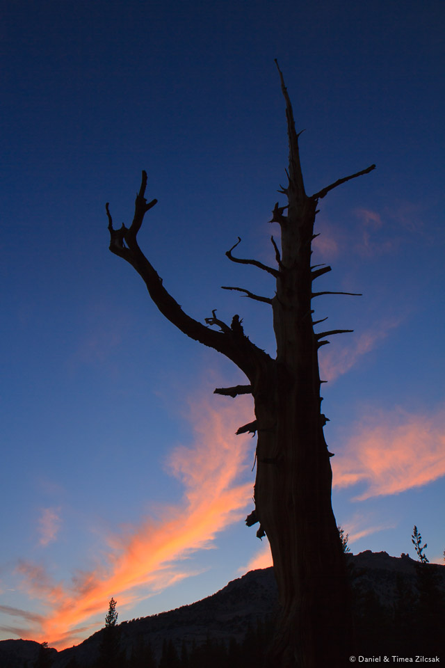
After another fabulous sausage and pasta dinner that Wes cooked for us, we went to bed, but not before admiring the darkest sky I have ever seen and taking a few quick shots to remember it.

Our camp at Sunrise with the constellation Scorpius visible in the Yosemite night sky

Milky Way and the Teapot asterism in the constellation Sagittarius clearly visible in the dark Yosemite night sky
It's surprising how many details get revealed on a longer exposure. I can clearly see the Lagoon Nebula (to the top right of the Teapot asterism) as well as other open clusters in this dense area of the Milky Way.
I illuminated the foreground trees by painting them with my headlamp for a second or two.
The second row of trees look like a shadow of the first row - they're clearly not, on closer inspection.
With that, we went to bed ending a long day, one that made some of the most lasting memories of this trip. But ahead of us, we had some more stuff to see and do, and three more days to spend enjoying the remote wilderness.
Day 5: Sunrise to Little Yosemite Valley
It's been four full days already! I could not believe how time flew out there.
We were ready to see Half Dome up close, so we woke up early again. Most days it took us about one and a half hours to wake up, have breakfast and break camp. That day was no exception.

Sunrise from Sunrise camp, backpacking Yosemite National Park
With this beautiful sunrise, we packed and left camp. It was about an hour of gentle climbing to reach the highest point, then, it was all downhill.
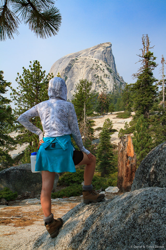
Once on the other side of the Sunrise Mountain, we had great views towards Yosemite Valley, Half Dome, and other peaks. These monolithic granite mountains were everywhere.
Time flew while enjoying those views and, at some point, we get to see Half Dome, much closer than before. We knew we were close to camp by then and could not wait to unload and relax for the reminder of the afternoon.

Descending from Sunrise towards camp at the bottom of Half Dome, backpacking Yosemite National Park
Little Yosemite Valley Campground
Bad news were waiting for us in camp. A mamma bear and two cubs had been aggressively trying to grab human food. Rangers on duty advised against camping at the bottom of Half Dome and asked us to rather descend all the way to Little Yosemite Valley, another 1.5 miles and about 1000 ft of elevation. So we did, mumbling as we passed through.
Section of trail in Little Yosemite Valley, near the campground where we spent two nights
We set camp and went straight to the river. We found a nice pool where we spend a few good hours enjoying the afternoon sun and taking a few dips. It was much hotter down here than any of the other places we spent time over the past 5 days. We loved it!
Day 6: Half Dome
Next morning we woke up before dawn to get ahead of the heat, and ahead of everybody else hiking Half Dome that day. We headed up the trail to gain back the 1000 ft lost the day before. Not too many people hiking that early, but a few rangers looking for the bear again. Several other hikers were lucky enough to see it, but not us.
We took the fork off the main trail and hiked another maybe 2 miles up to reach the bottom of Sub Dome. It took about an hour and a half in total to get there from Little Yosemite Camp.
Smoke from the fires was everywhere that morning and it looked at its worse since we got there a few days before.


The sun was now rising and there was a slight chance of lightning so we kept alert. The Sub Dome itself was steep and a little exposed in places. It took a bit to get used to and we were up at the bottom of the cables in about 15 minutes.
Then, we saw the cables leading to the top of Half Dome.

The famous steep Half Dome cables - Backpacking Yosemite National Park
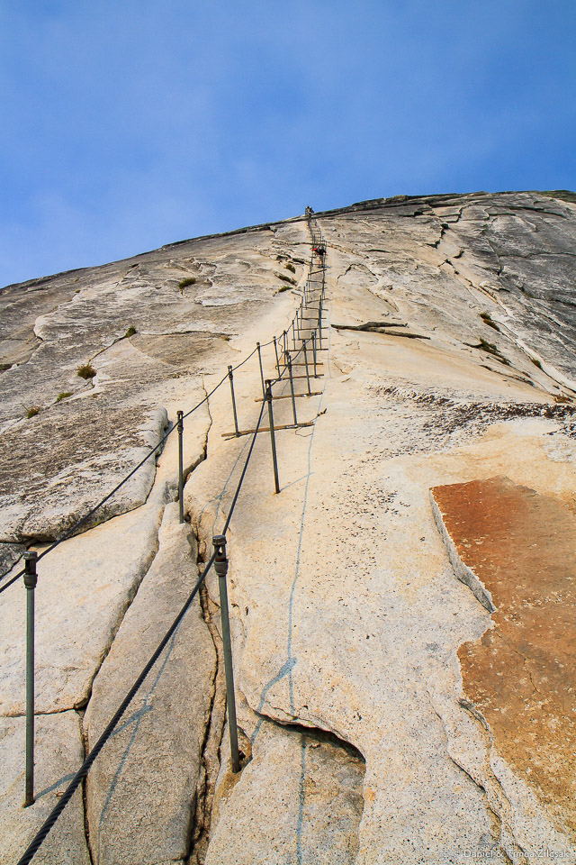


Looking back towards the Sub Dome from the bottom of the Half Dome cables
Ana, Wes and Steve were the only ones in our group that climbed it all the way. Way to go guys! The rest of us could not summon enough courage to ignore the slippery granite at the cables, the exposure, the insane wiggling of the steel cables or the folks sliding down sometimes erratically. Personally, I was perfectly fine not climbing it. Maybe with better footwear, on another occasion I'll be admiring the views from up top.
Sub Dome and Half Dome behind it. Zoom in to see folks looking for a better view.
Looking back towards Half Dome
Back to camp and our little swimming spot on the Merced River, we enjoyed a calm afternoon with lots of fun. We knew the trip was coming to an end, we all had mixed feelings about it. Of course, one of the most talked about things was that beer and burger that was calling us from the valley below. I wasn't sure that I was ready to leave yet, though.
Day 7: Back to Curry Village and Yosemite Valley
Off to finish the last leg of our trip. It took us very little time to descend. Our packs were now practically empty, but we were carrying something else instead, in our hearts: a memory that will last a life time.

Joe, myself, Ana and Timea - at the top of Nevada Fall, Backpacking Yosemite National Park

Mules carrying supplies for High Sierra Camps - Backpacking Yosemite National Park
For some reason we took the John Muir trail down instead of the Mist Trail. We got to see Nevada Falls and the giant Liberty Cap from a different angle.


Without exaggerating too much, it felt like we passed a million people on our way down the paved trail to the village. After a week in the wilderness, when if we saw 20 people a day was a lot, seeing so many folks all of a sudden felt... weird. They all had clean clothes and smelled fresh, too! But I was not envious at all. Like I said before, besides the backpacking scent I was wearing something special that day: those memories.
Happy Isles and Curry Village
We stopped as a group at the Curry Village patio and celebrated a great trip with burgers and large beers.

An after lunch group shot

The moon touching the mountain from a bridge near Happy Isles, Yosemite Valley

A group of teenagers' backpacks before their hike, Yosemite National Park
What a trip!
We learned so many things, had so many new experiences to remember for a lifetime, and made new friends that we hope to keep in touch throughout the years. Thanks Jim, Anna, Joe, and especially Wes for such an extraordinary trip!
Also, thank *you* for reading this far!
Update: Just recently we've completed the entire John Muir Trail, from Yosemite to Mount Whitney. Read about our journey on The John Muir Trail - a Complete Day by Day Story and Guide page with, as always, tons of photos.