
Backpacking the Olympic South Coast Wilderness Trail
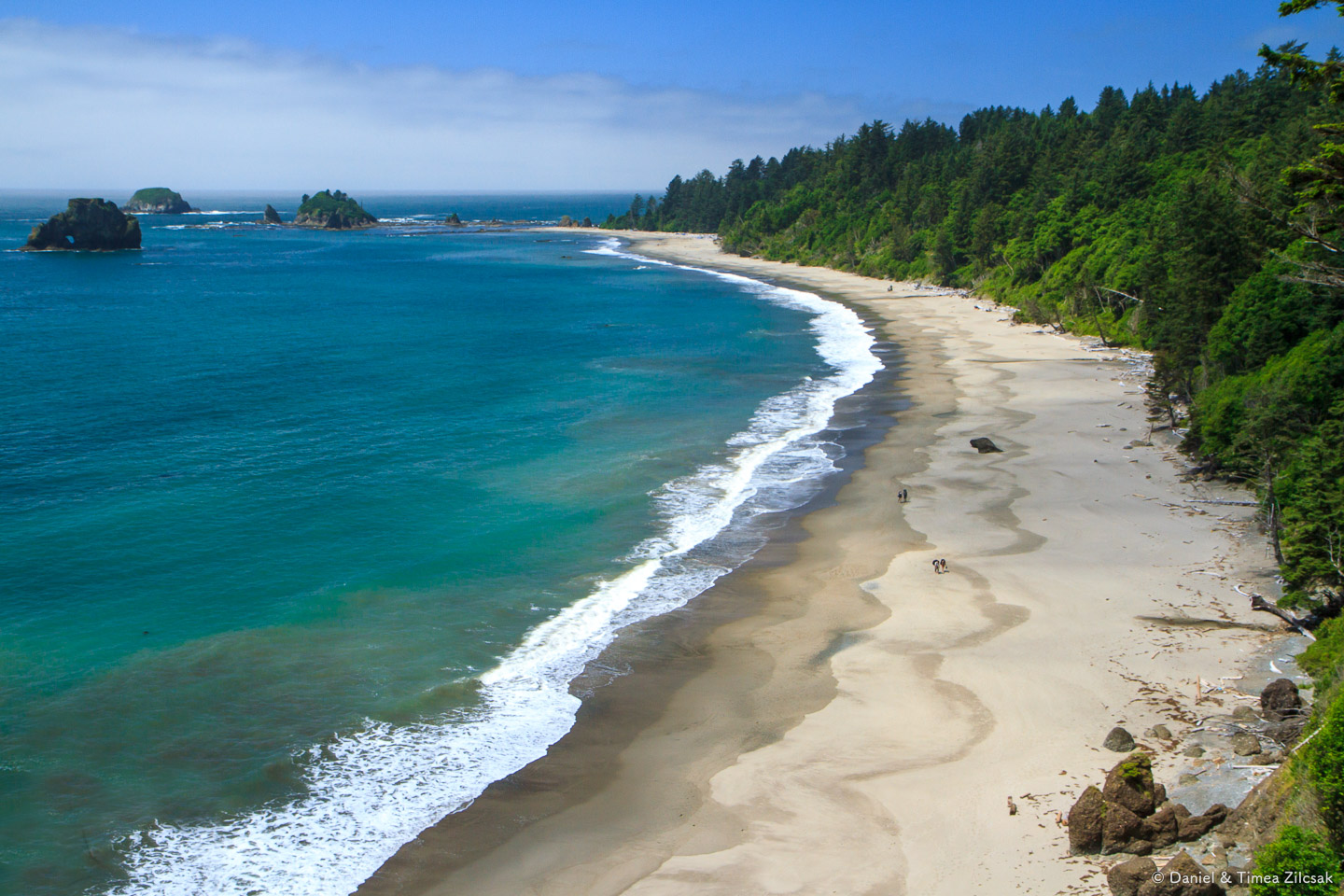
There are few places as wild and beautiful as Toleak or Strawberry Point, to name just a few of the South Coast Wilderness Trail's highlights. This 17 mile stretch of wild Pacific Ocean beaches and cliffs, from Third Beach to Oil City, was our destination for this long weekend backpacking trip.
A recap of Part 1: Third Beach to Toleak Point
In Part 1, I was describing our first day, driving 5 hours from Seattle, picking up permits, leaving one car at the Oil City trailhead, returning to the northern start point, Third Beach, the amazing beach hike along Strawberry Bay, Taylor Point, Giant's Graveyard, Strawberry Point, its intricate inland detours, culminating with the amazing sunset and camp fire at Toleak Point, where we spent the first night.
Part 2: Second Day, Breakfast at Toleak Point
We had an uneventful first night, or so we thought.
The day before, Krisztina could not fit her pita bread in any of the bear canisters we had with us, and so she decided to take the chance and leave it out. Right around breakfast time she realized that her pita bread was nowhere to be found. It was gone! It probably made some raccoon family very happy. Lesson learned to never leave food unprotected.
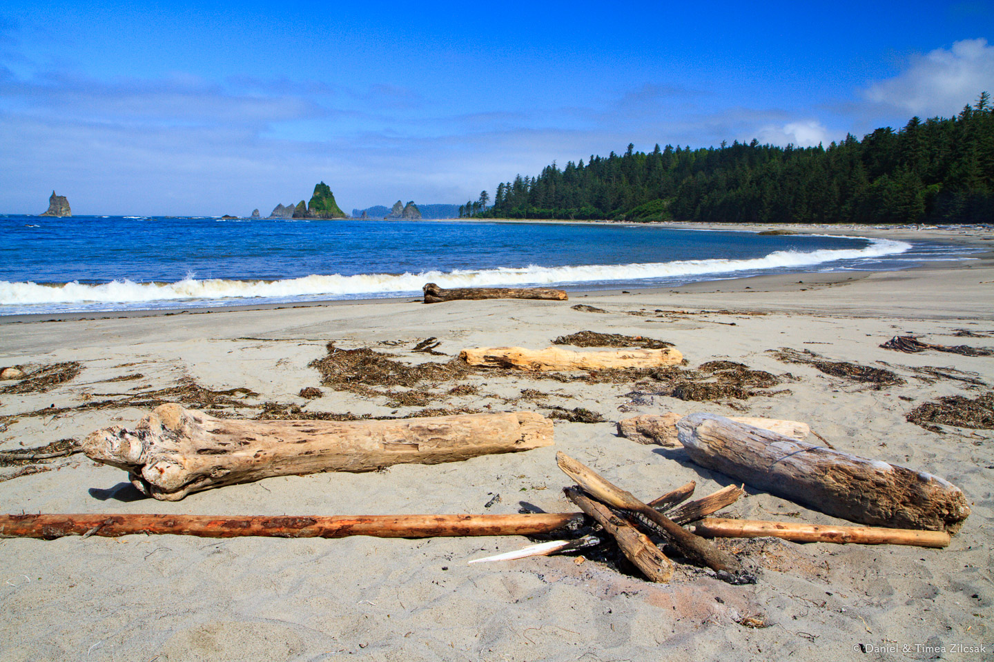
Once we got over the bread mystery, we made plans for what was ahead of us. We were going to have an easy day, so after breakfast we decided to hang around camp and take our time packing. I used this opportunity to capture a few pictures of the area.
As I walked around the beach, some unusually colorful thing caught my eye. It was debris from fishing nets, tangled in the beach vegetation. Looking closer at some of the buoys, like the ones below, I saw they had what looked to me like Japanese writing. I suspect they might have been ripped out of a ship during the 2011 tsunami that hit Japan so bad. Maybe the fishing nets are from that tragic event, too.

Fishing net debris near Toleak Point, South Coast Wilderness Trail

Fishing debris near Toleak Point, South Coast Wilderness Trail
It was 11:30am and we were wrapping up our camp just as a bald eagle landed on top of the rock that stood by our campsite. It kept an eye on us as we were getting ready to leave, and also on the family of hikers that passed by our camp.

Family of hikers being watched by a bald eagle from high atop the rocks

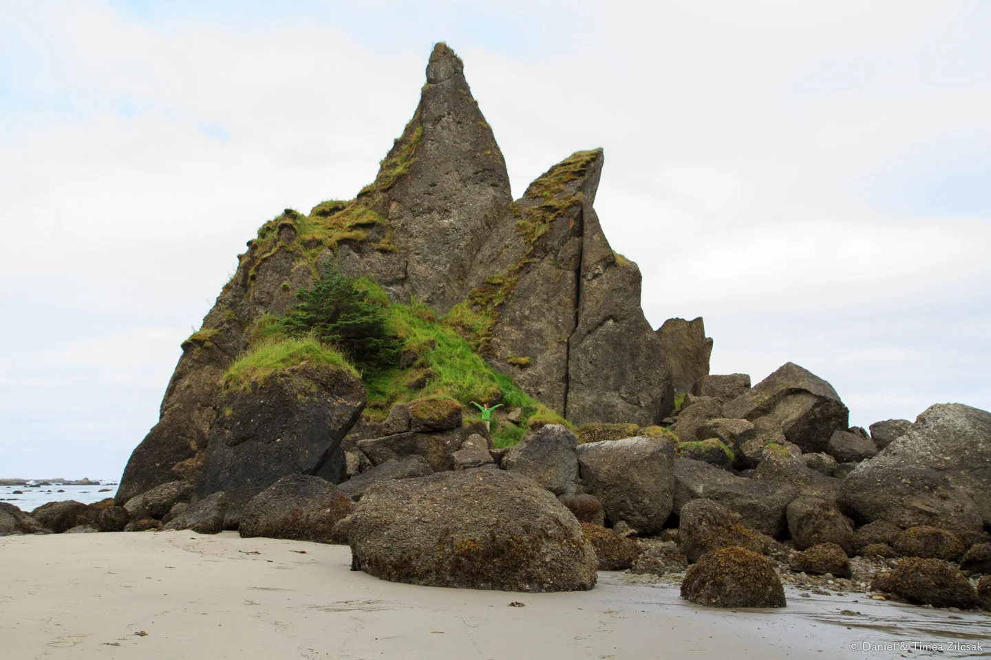
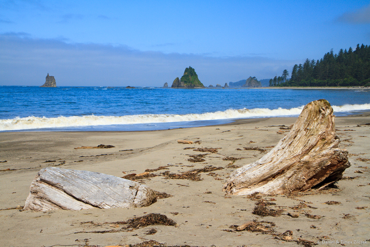
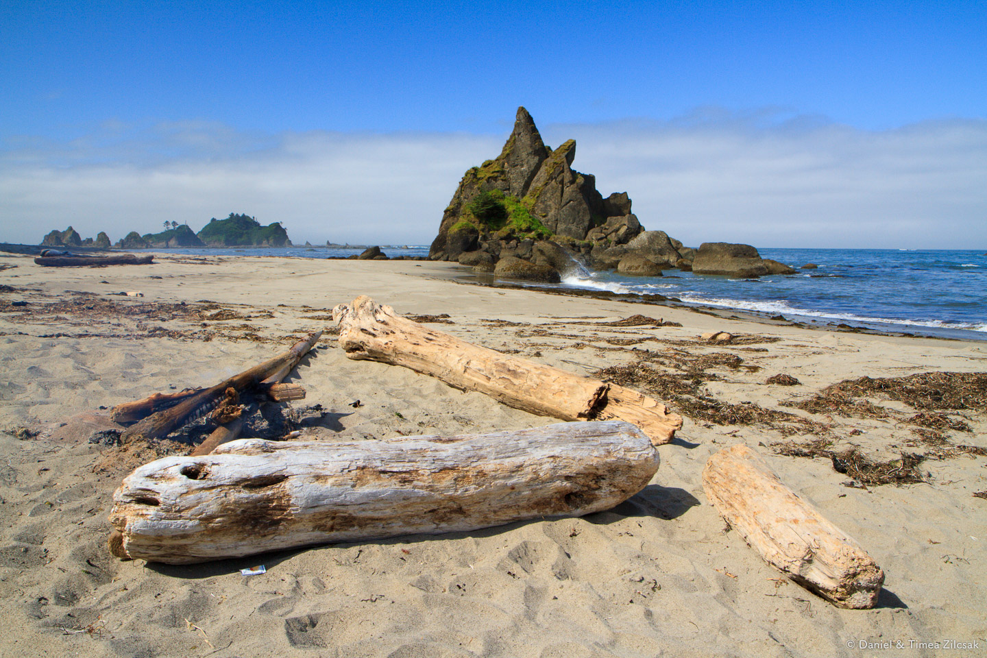
Once out of camp, we retraced our steps from the day before, towards the very tip of Toleak Point. Before we took the corner to follow the trail, we stopped among the large rocks to check them out from up-close.
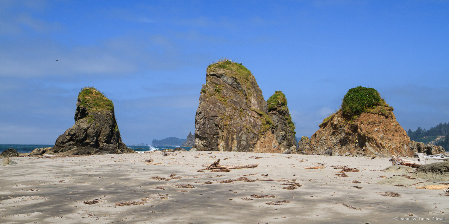
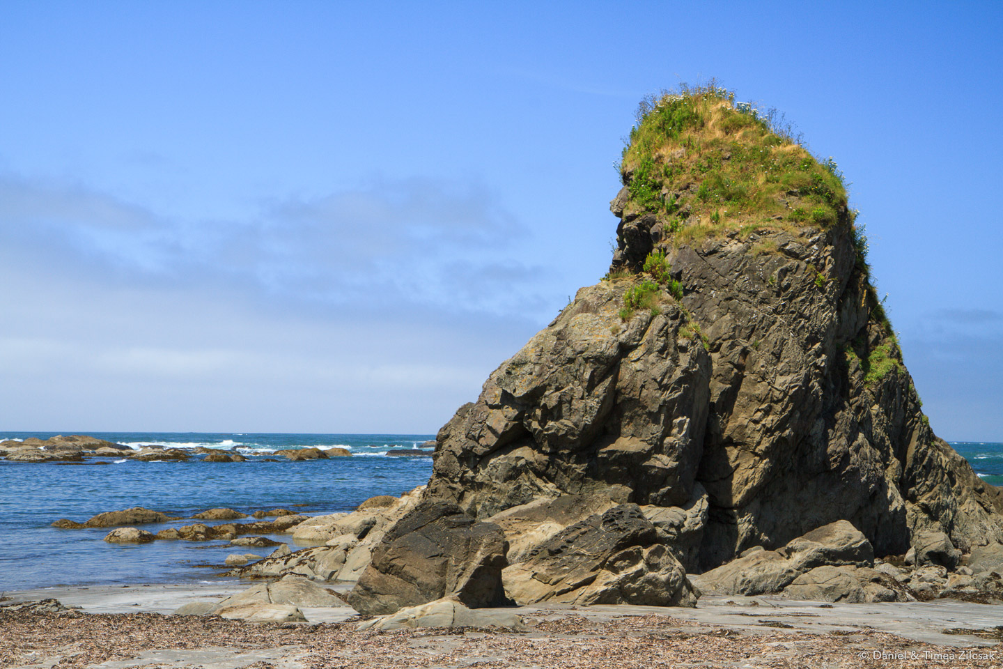

Toleak Camp and Jackson Creek
As we advanced around the tip, we found Jackson Creek and stooped to filter some water for the hike ahead.

Jackson Creek flowing into the Pacific Ocean at Toleak Point Camp on the South Coast Wilderness Trail, Olympic National Park
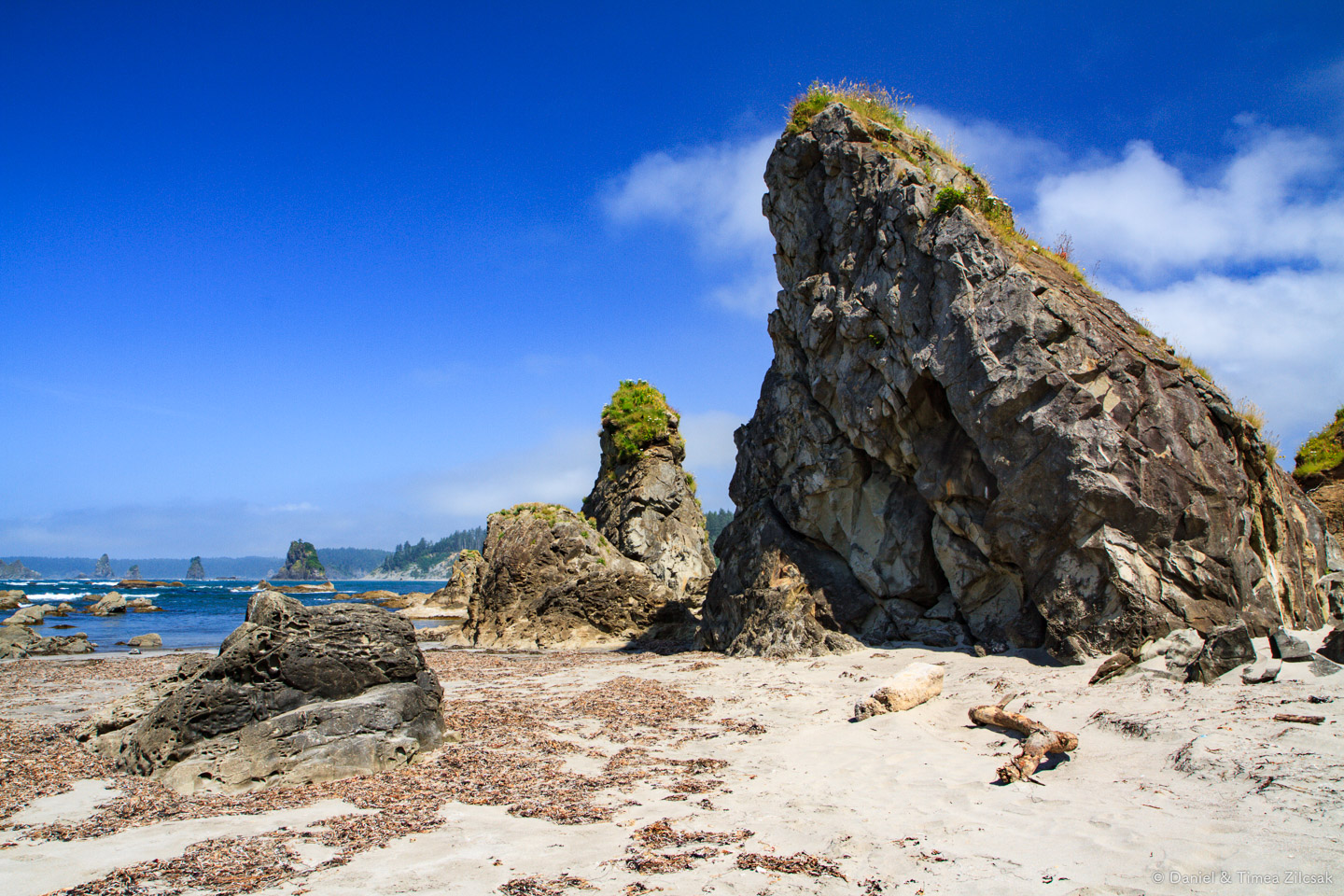
Looking back towards Toleak from father away, South Coast Wilderness Trail
South Coast Wilderness Trail, Olympic National Park
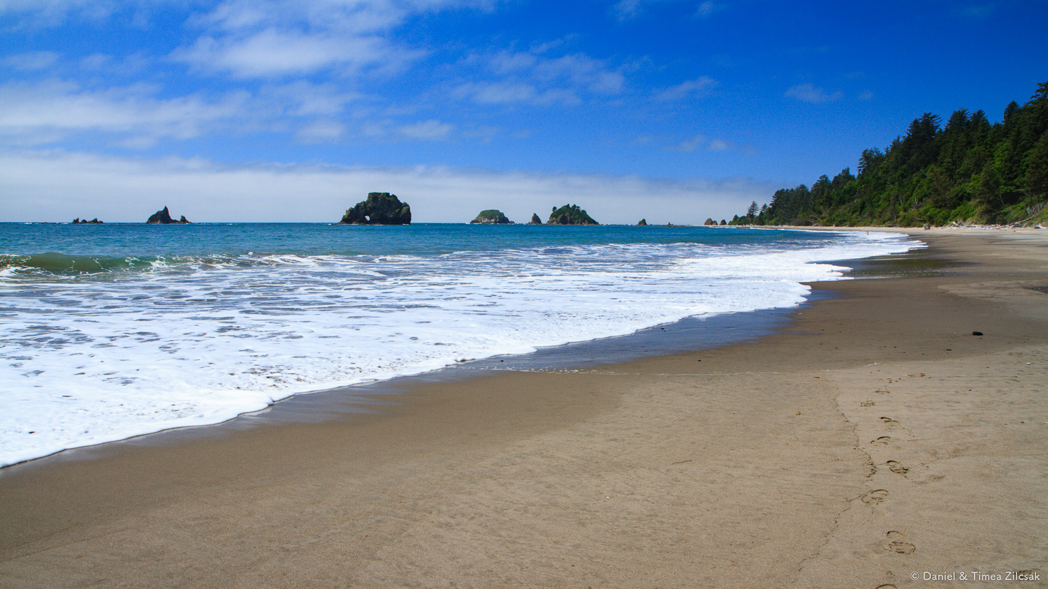
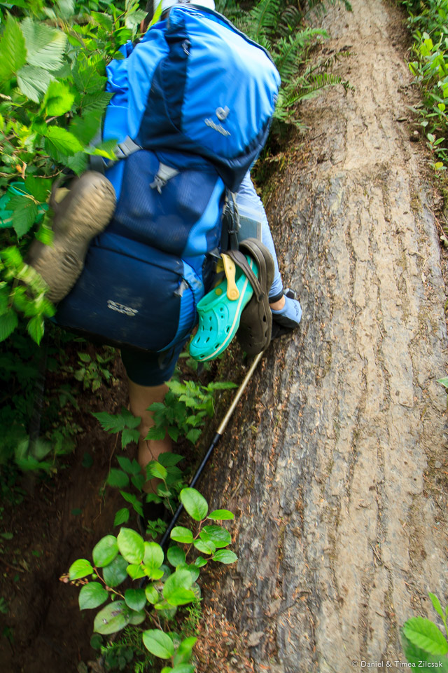
We did not walk for a long time before the beach ended and the trail followed another rope up into the trees. This time, the inland section was going to be a little longer. Before we left the beach for good, we got another chance to see it from a higher vantage point. Beautiful place! Down below we could see the same folks that we met the day before. They were now making their way up onto the cliff, right behind us.


Looking back towards Toleak Point on the South Coast Wilderness Trail, Olympic National Park
Falls Creek
The trail trough the forest was a little longer than I thought it would be. It took us about an hour and a half to emerge on the other side of the headland, including a 20 minute stop for a snack at Falls Creek.

Falls Creek south of Toleak Point on the South Coast Wilderness Trail, Olympic National Park
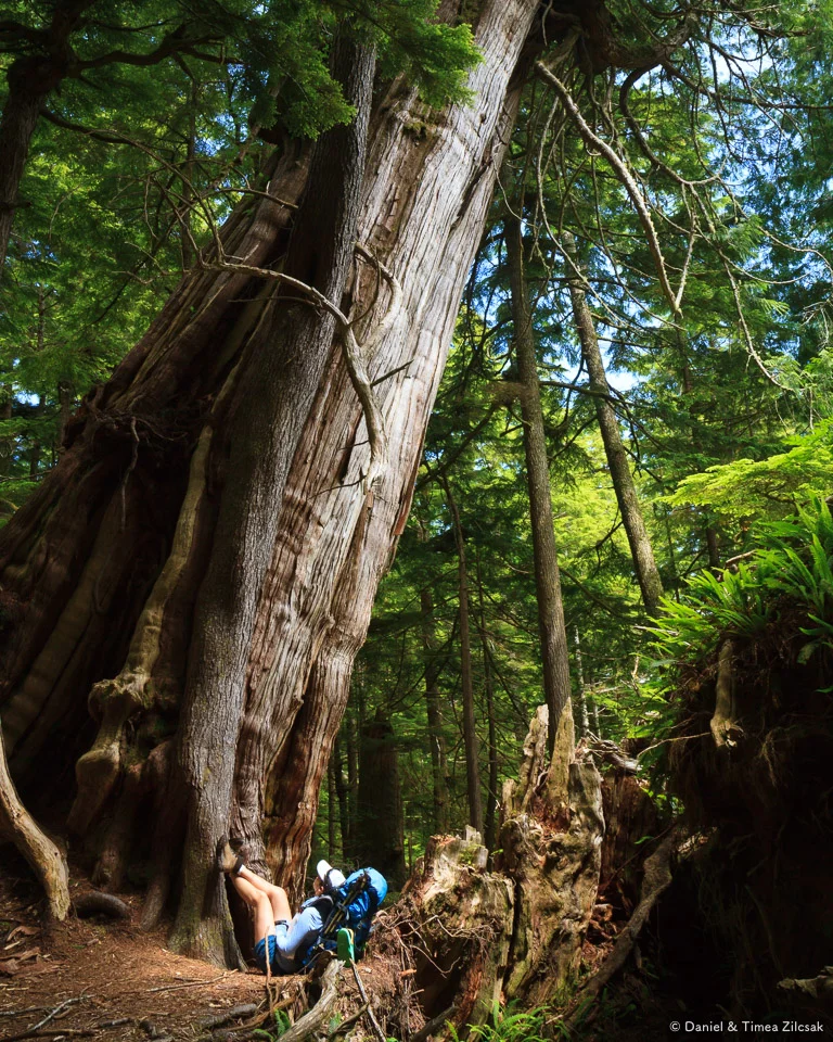
Along the way we found this outstanding tree where we all took turns having our picture taken.
South Coast Wilderness Trail south of Toleak Point, Olympic National Park

South Coast Wilderness Trail south of Toleak Point, Olympic National Park
We had enough walking though mud and shade! We were hoping for the weather to clear and for some sunshine. Before I finished my thought, we reached another rope leading us to a wide stretch of beach, on the other side of the head. This was our chance to brighten up.

South Coast Wilderness Trail south of Toleak Point, Olympic National Park
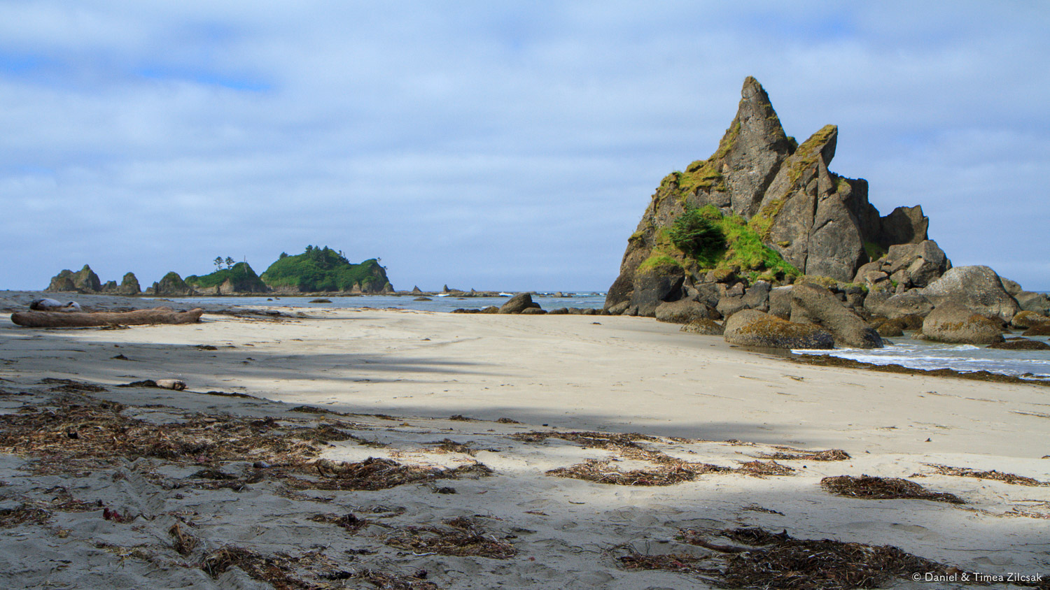
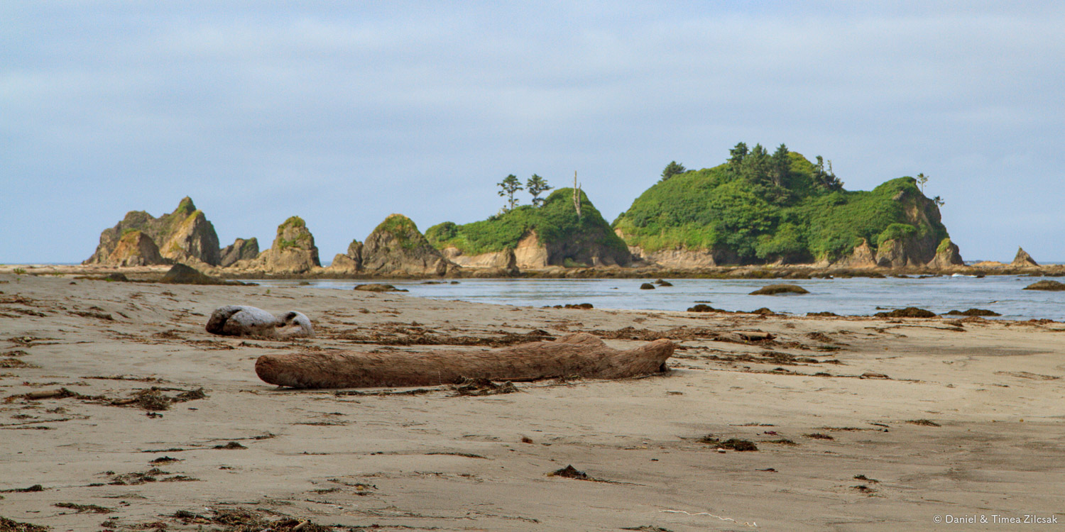
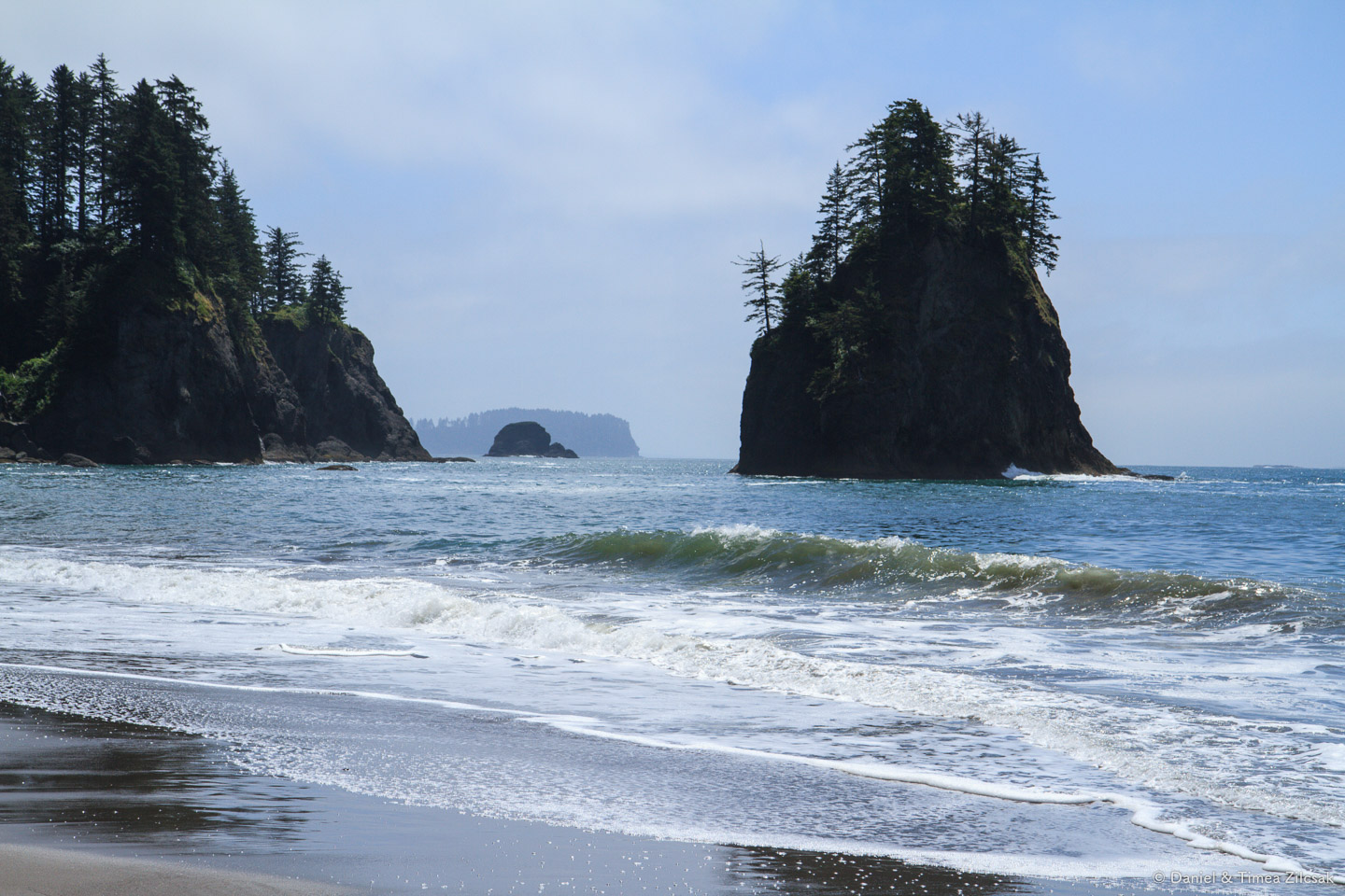
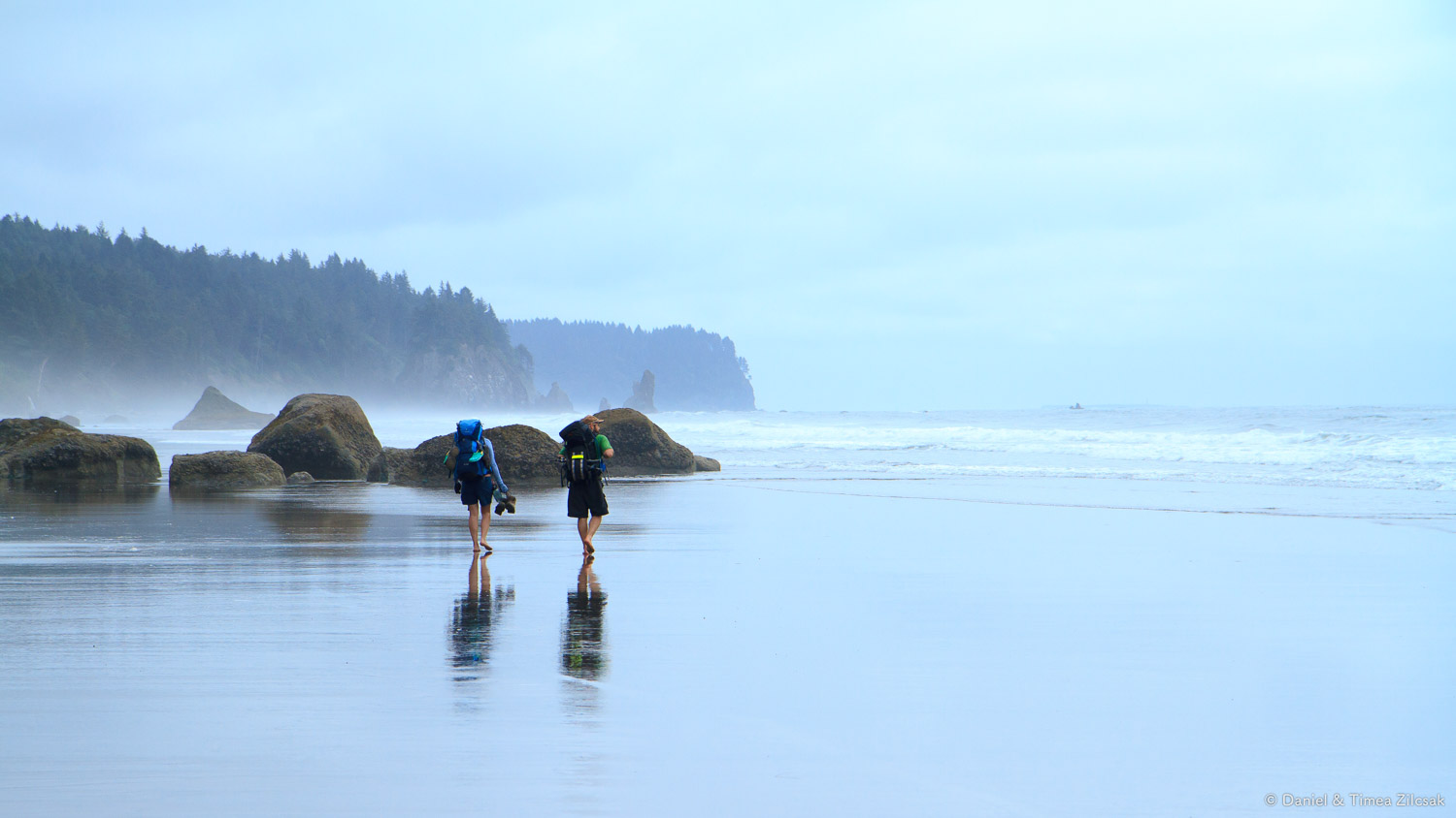
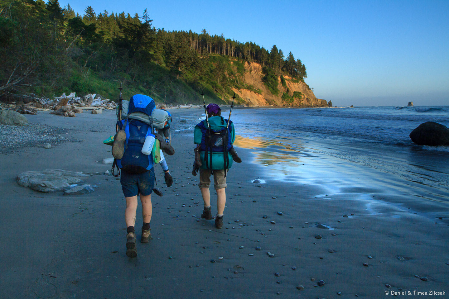
Beach Hiking, Alexander Island
We didn't have any luck getting the clouds out of the way for some warmth, but regardless, the beach and the ocean was still spectacular along this stretch of wild coastline. Alexander Island (at the horizon in the image below) was standing guard to the west, surrounded in fog and mystery. Looking at its flat top made me wonder what's it like to be out there, especially in bad weather.

Beach hiking along South Coast Wilderness Trail, Alexander Island at the horizon
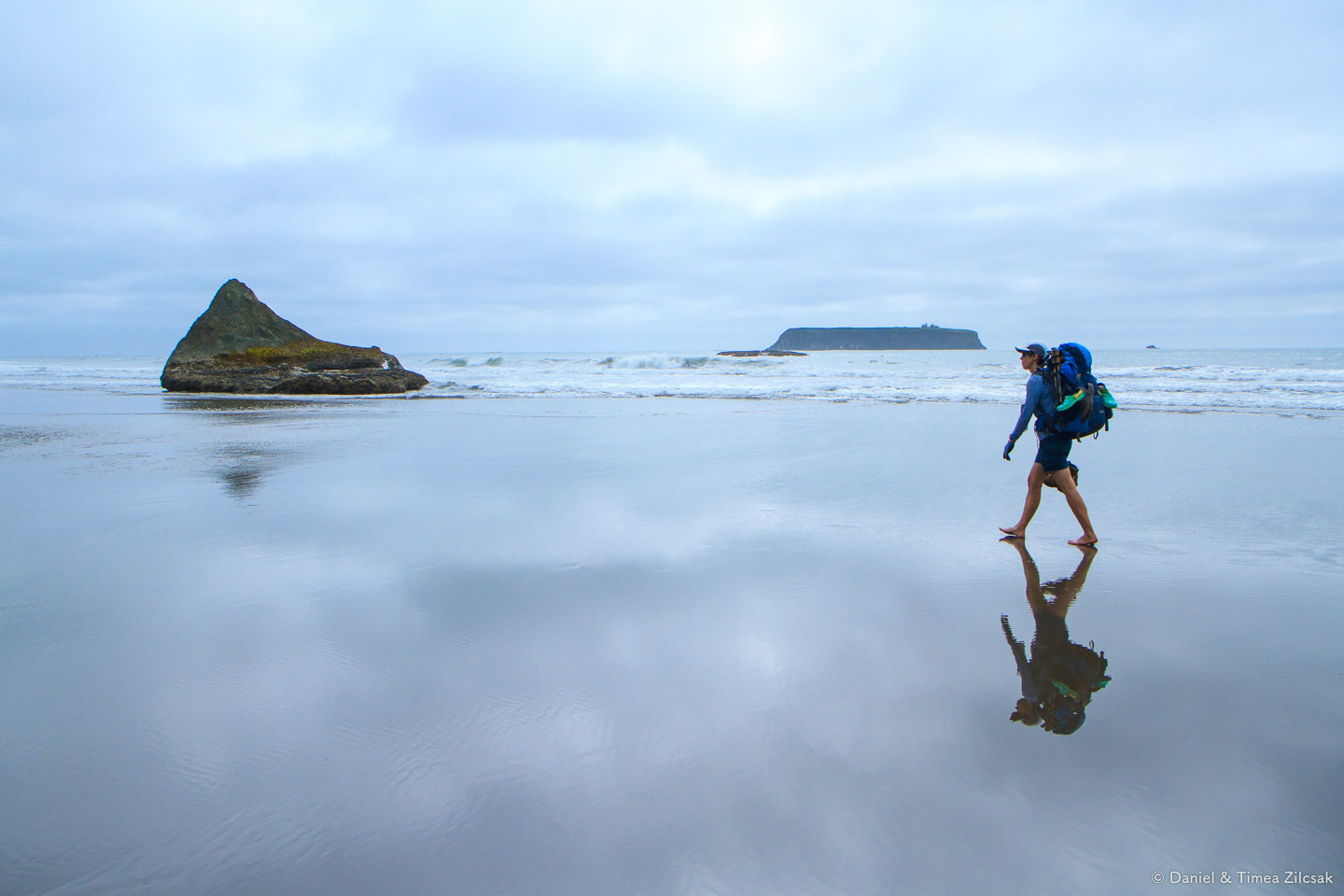
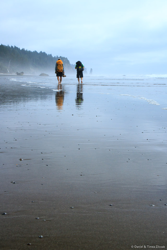
Backpacking barefoot on the Olympics' South Coast Wilderness Trail
It was a cooler day than the one before, but we eventually got used to it. We even took our boots off to enjoy the soft sand. We figured almost immediately, thought, that it's harder to walk barefoot when you carry a 40 pound pack.


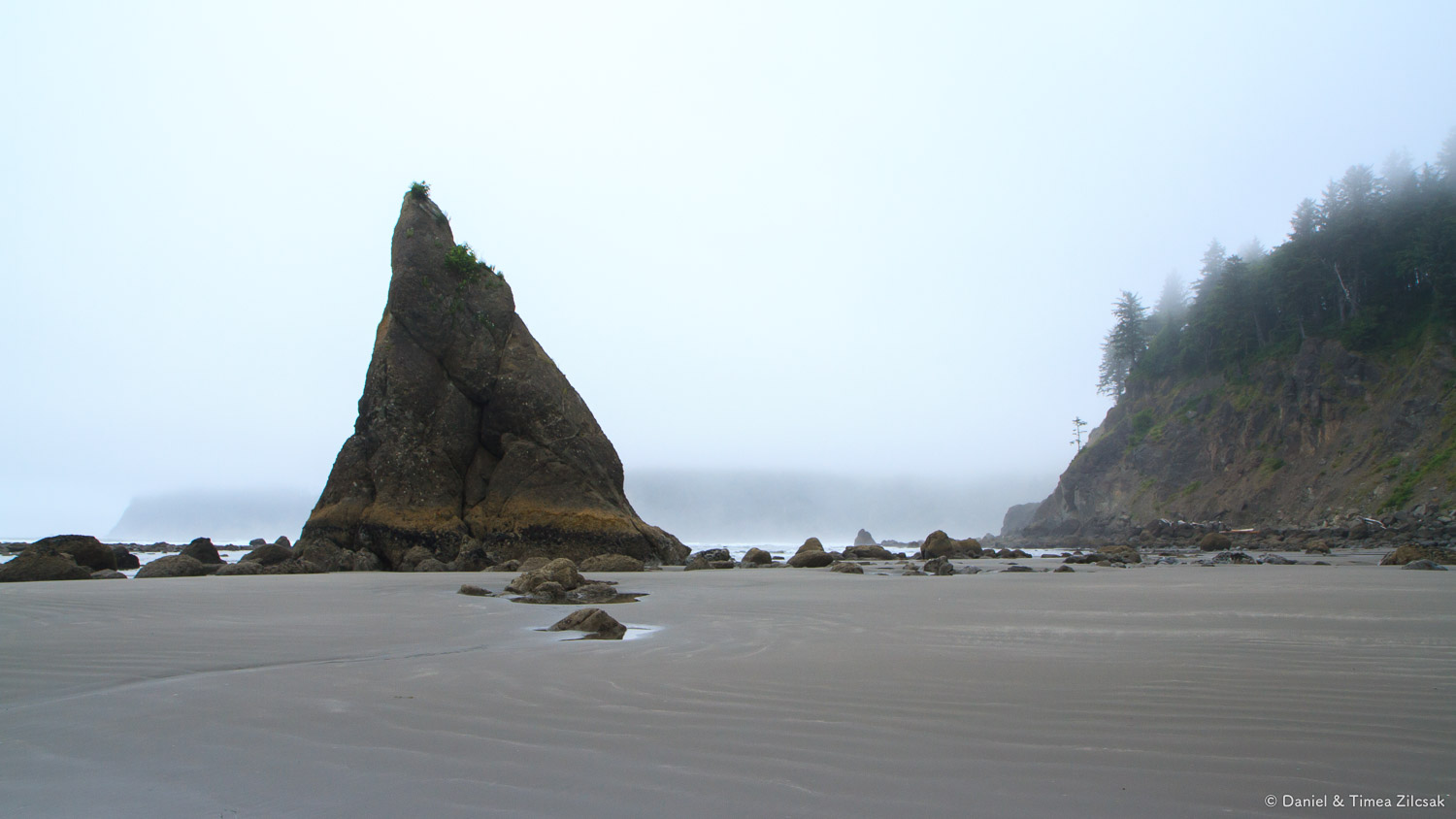
Not sure if this rock on the right has a name but it looks like a sleeping ox to me.
Mosquito Creek Camp
After a little over 2 hours of walking on this beach, we finally reached the camp at Mosquito Creek. We were hoping for a nice camp-fire here, for some sunshine, and for some good news about the Jefferson Cove rounding that was ahead of us. Neither of them turned out to be in our future, as we soon discovered.

Camp at Mosquito Creek on the South Coast Wilderness Trail, Olympic National Park
As we were filtering water in the nearby creek, we learned from another hiker that the Jefferson rounding was only possible at the lowest tide, which was going to be at 5am. The bad news was that we were still miles away from that point.
It was 4 pm and, given that we could not stop to spend the night here at Mosquito Creek, we decided to hike on and camp at Jefferson Cove. We were tired and 3.5 more miles through dense forest were not going to be taken well by the group, but we had to do it as we did not bring enough food for 2 more nights, and there was no other way out. So we carried on.
The next section was muddy, steep, and dark, and such a different feel than what we had before. It was thrilling and an experience that none of us will easily forget. The mud was so deep that the vacuum it created could almost suck your boot out.

Mud so deep that it could almost suck your boot out, South Coast Wilderness Trail
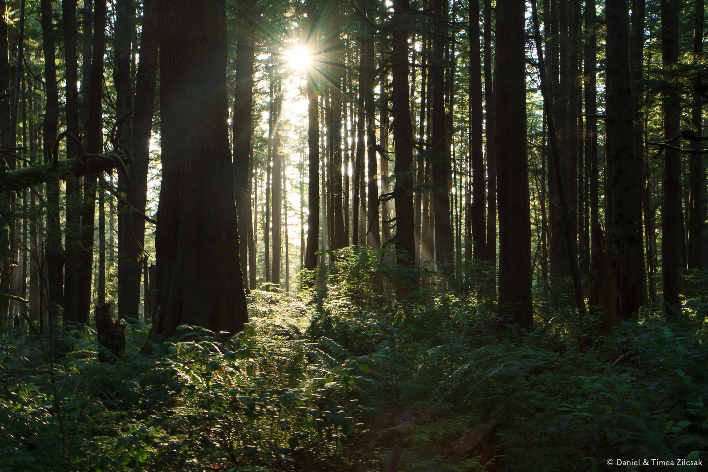
A dark forest with the sun setting along the South Coast Wilderness Trail, Olympic National Park
Hoh Head and Jefferson Cove
A little after 7pm and about 3 hours since we left Mosquito Creek camp, we got to the steepest and longest ladder on the entire trail. This was the very last section before descending into Jefferson Cove, which was going to be our camp for the night.

Ladder descending into Jefferson Cove, South Coast Wilderness Trail

Ladder descending into Jefferson Cove, South Coast Wilderness Trail
As we left the woods behind and stepped onto the beach at Jefferson Cove, we noticed that the sky had cleared and we were looking at a beautiful sunset behind Hoh Head. This beach is so pretty, and so cozy!
Hungry backpackers looking for a safe campsite at Jefferson Cove on the South Coast Wilderness Trail
Camp at Jefferson Cove
We found the nicest place to lay our tent, made a sizable fire, and had a hearty dinner, during which we noticed that the tide was getting closer and closer to our camp. We checked and double checked, we were in absolute highest spot on the entire beach. We also knew the closest tide will be around 11pm, so we waited out to see if we will be in any danger. We were fine eventually, but it was a bit unsettling to hear water spray hit our tent fly every now and then while we were falling asleep.

Sunset behind Hoh Head from our camp at Jefferson Cove on the South Coast Wilderness Trail, Olympic National Park
Day 3
The following morning, the tide charts forced us to wake up at 4:30am so can make it around the section that was impassable later in the day. We needed to get out before the water would close the gap again.
Nearby camp, where there was a raging ocean the night before, now it was just wet sand and washed out algae. The water line was hundreds of yards away from our camp!

Shoreline at Jefferson Cove on the South Coast Wilderness Trail, Olympic National Park

South Coast Wilderness Trail, Olympic National Park
In the image below, we're moving across a bolder field, where receded water left behind a beautiful landscape. The rocks were very slippery, all of them being covered in algae and sea shells. Hoh Head visible to the right across Jefferson Cove, enveloped in thick mist.


Looking back to where we came from, across fine sand, where water was ruling not too many hours before.
South Coast Wilderness Trail, Olympic National Park
Once we passed this section we continued our hike, and shortly we realized that we were almost there. We were almost at the Oil City trailhead, and our trip was about to come to an end.

We're almost at the Oil City trailhead, South Coast Wilderness Trail
It only took about an hour or so from Jefferson Cove to reach the Oil City trailhead. We had the entire day ahead of us to enjoy a meal in Port Angeles and to get back home. But before that, we still had a car we needed to pick up from Third Beach!
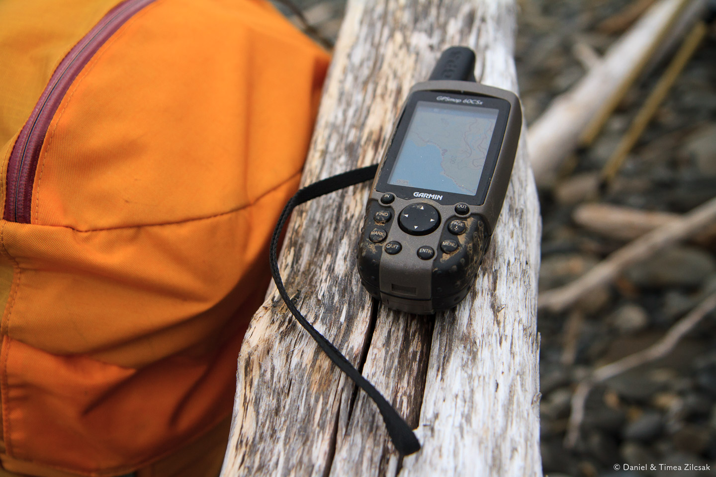
My GPS worked hard to capture our route

South Coast Wilderness Trail sign - Oil City to Toleak Point to Third Beach (in reverse)
On our way home, on the Walla-Walla ferry from Kingston to Edmonds, we got one last nice view before we crossed into heavy city traffic: Mount Rainier and Seattle across the blue waters of Puget Sound.

View of Mount Rainier and Seattle from the Walla Walla ferry, across Puget Sound from Kingston to Edmonds
Hey, thanks for reading so far folks!
If you have not been on this trip before, put it on your list. You won't be disappointed!